Stockton night lights from space
Night Light of Stockton (California) from space (United States) Src. Average luminocity for 10x10km area is 88.7711% and for 50x50km: 23.0868%.
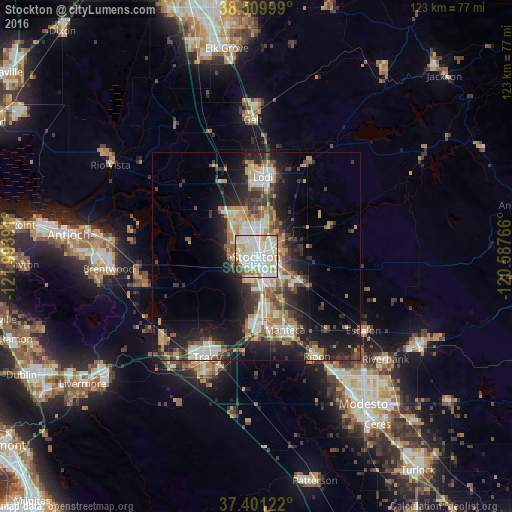
Analysis of Stockton night lights 2016
Square area 10x10 km:
 36.69%
90-99
31.17%80-89
9.58%70-79
9.25%60-69
4.87%50-59
3.08%40-49
2.92%30-39
0.65%20-29
1.79%10-19
0%0-9
0%Square area 50x50 km:
4.14%90-99
4.25%80-89
1.62%70-79
3.95%60-69
2.86%50-59
2.78%40-49
3.53%30-39
3.93%20-29
6.8%10-19
12.53%0-9
53.62%Clear (daylight) street map image can be seen on geolist.org.
Map coordinates:
38° 30' 36" North, 121° 59' 38.1" West
37° 57' 27.7" North, 121° 17' 26.8" West
37° 24' 4.4" North, 120° 35' 15.6" West
Some cities around Stockton sort by population:
• Tracy
27 km =16.8 mi,  206°
206°
• Manteca
19 km =11.8 mi,  159°
159°
• Lodi
19.2 km =11.9 mi,  4°
4°
• Lathrop
15.1 km =9.4 mi,  175°
175°
• Discovery Bay
27.7 km =17.2 mi,  258°
258°
• Garden Acres
5.4 km =3.4 mi,  82°
82°
• Country Club
4.6 km =2.9 mi,  285°
285°
• August
3.4 km =2.1 mi,  46°
46°
5399020 (p: 305,658)
Sources (retrieved 2019-11-25):
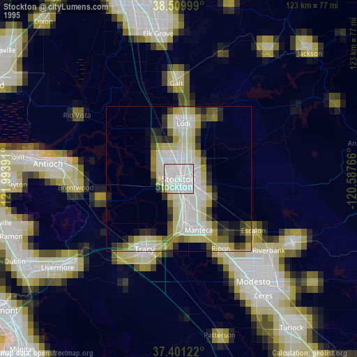
» NASA, Earths city lights 1995
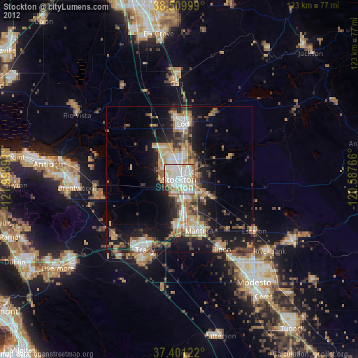
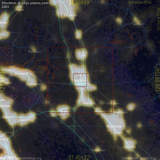
» NASA city lights 2003
» Earth at Night: Flat Maps 2012, 2016