Tracy night lights from space
Night Light of Tracy (California) from space (United States) Src. Average luminocity for 10x10km area is 62.3793% and for 50x50km: 17.9302%.
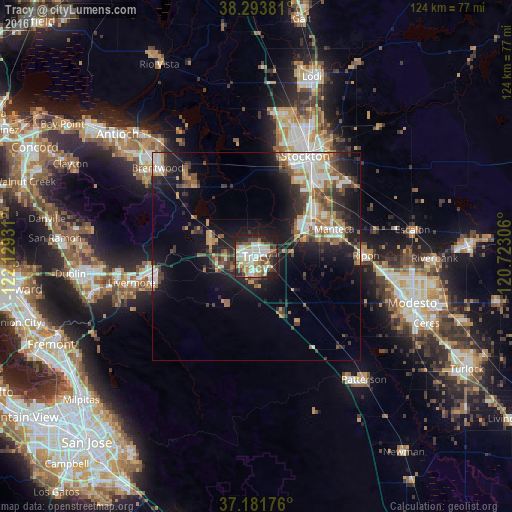
Analysis of Tracy night lights 2016
Square area 10x10 km:
 12.76%
90-99
16.16%80-89
9.35%70-79
8.67%60-69
7.48%50-59
7.14%40-49
8.33%30-39
7.99%20-29
13.61%10-19
8.5%0-9
0%Square area 50x50 km:
2.92%90-99
2.94%80-89
1.2%70-79
2.69%60-69
2.38%50-59
2.58%40-49
2.95%30-39
3.02%20-29
5.17%10-19
11.59%0-9
62.55%Clear (daylight) street map image can be seen on geolist.org.
Map coordinates:
38° 17' 37.7" North, 122° 7' 45.5" West
37° 44' 23.5" North, 121° 25' 34.2" West
37° 10' 54.3" North, 120° 43' 23" West
Some cities around Tracy sort by population:
• Stockton
27 km =16.8 mi,  26°
26°
• Manteca
19.5 km =12.1 mi,  70°
70°
• Lathrop
16 km =9.9 mi,  54°
54°
• Ripon
26.5 km =16.5 mi,  89°
89°
• Discovery Bay
24.2 km =15 mi,  320°
320°
• Mountain House
11.3 km =7 mi,  295°
295°
• Country Club
26.5 km =16.5 mi,  16°
16°
• August
30.2 km =18.8 mi, 28°
5403191 (p: 87,075)
Sources (retrieved 2019-11-25):
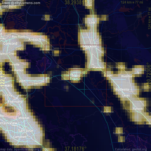
» NASA, Earths city lights 1995
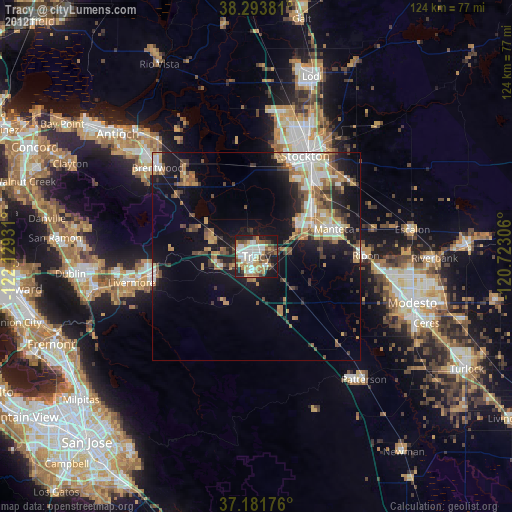
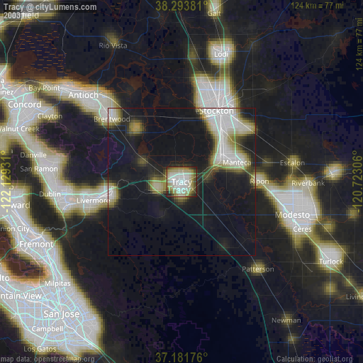
» NASA city lights 2003
» Earth at Night: Flat Maps 2012, 2016