Brentwood night lights from space
Night Light of Brentwood (California) from space (United States) Src. Average luminocity for 10x10km area is 50.3036% and for 50x50km: 17.8869%.
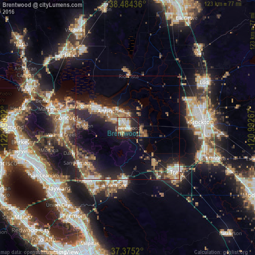
Analysis of Brentwood night lights 2016
Square area 10x10 km:
 8.6%
8.6%90-99
12.5%80-89
4.38%70-79
9.74%60-69
6.17%50-59
7.79%40-49
3.41%30-39
4.55%20-29
13.15%10-19
28.73%0-9
0.97%Square area 50x50 km:
2.13%90-99
2.46%80-89
0.99%70-79
2.91%60-69
2.94%50-59
3.74%40-49
3.09%30-39
2.41%20-29
6.61%10-19
11.42%0-9
61.29%Clear (daylight) street map image can be seen on geolist.org.
Map coordinates:
38° 29' 3.7" North, 122° 23' 56.1" West
37° 55' 54.7" North, 121° 41' 44.8" West
37° 22' 30.7" North, 120° 59' 33.6" West
Some cities around Brentwood sort by population:
• Antioch
12.6 km =7.8 mi,  310°
310°
• Pittsburg
19.7 km =12.2 mi,  302°
302°
• Oakley
7.4 km =4.6 mi,  348°
348°
• Bay Point
25.7 km =16 mi,  294°
294°
• Discovery Bay
8.8 km =5.5 mi,  107°
107°
• Clayton
21.1 km =13.1 mi,  272°
272°
• Mountain House
21.3 km =13.2 mi,  140°
140°
• Blackhawk
22.3 km =13.9 mi,  236°
236°
5330642 (p: 58,968)
Sources (retrieved 2019-11-25):
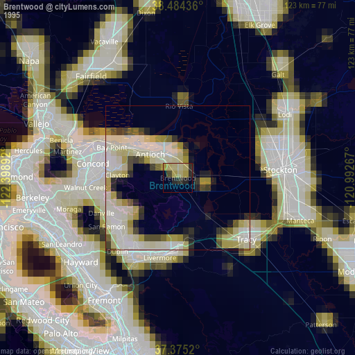
» NASA, Earths city lights 1995
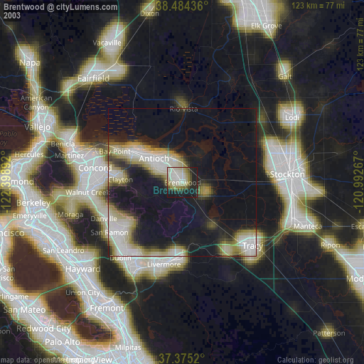
» NASA city lights 2003
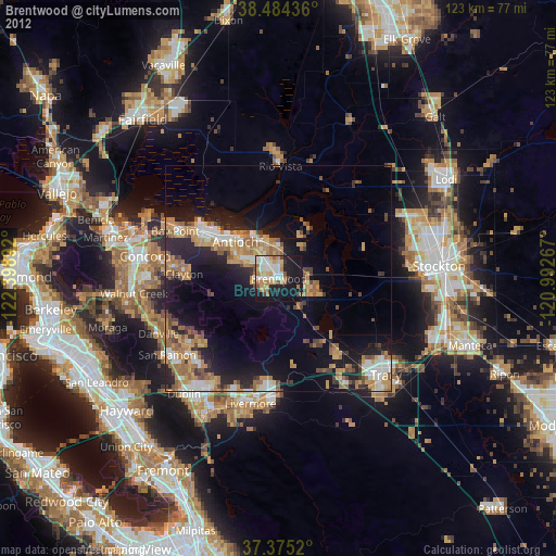
» Earth at Night: Flat Maps 2012, 2016