Antioch night lights from space
Night Light of Antioch (California) from space (United States) Src. Average luminocity for 10x10km area is 55.0877% and for 50x50km: 18.6845%.
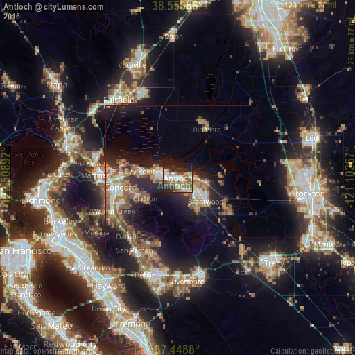
Analysis of Antioch night lights 2016
Square area 10x10 km:
 11.04%
90-99
13.15%80-89
1.79%70-79
6.49%60-69
10.71%50-59
12.01%40-49
8.12%30-39
3.08%20-29
20.29%10-19
13.31%0-9
0%Square area 50x50 km:
2.15%90-99
2.44%80-89
0.83%70-79
3.24%60-69
3.8%50-59
4.27%40-49
3.09%30-39
2.4%20-29
6.12%10-19
11.34%0-9
60.32%Clear (daylight) street map image can be seen on geolist.org.
Map coordinates:
38° 33' 24.7" North, 122° 30' 32.1" West
38° 0' 17.7" North, 121° 48' 20.8" West
37° 26' 55.7" North, 121° 6' 9.6" West
Some cities around Antioch sort by population:
• Concord
20 km =12.4 mi,  261°
261°
• Pittsburg
7.4 km =4.6 mi,  290°
290°
• Brentwood
12.6 km =7.8 mi,  130°
130°
• Oakley
8.2 km =5.1 mi,  95°
95°
• Bay Point
13.9 km =8.6 mi,  281°
281°
• Discovery Bay
21 km =13 mi,  120°
120°
• Clayton
13.4 km =8.3 mi,  238°
238°
• Rio Vista
20.1 km =12.5 mi,  28°
28°
5324200 (p: 110,542)
Sources (retrieved 2019-11-25):
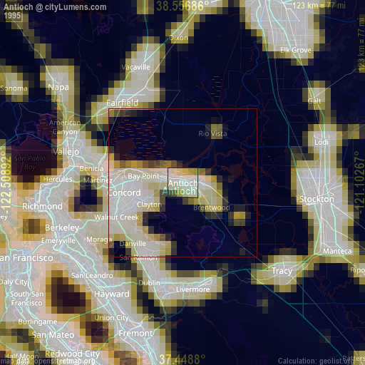
» NASA, Earths city lights 1995
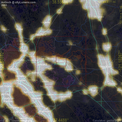
» NASA city lights 2003
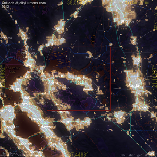
» Earth at Night: Flat Maps 2012, 2016