Mount Prospect night lights from space
Night Light of Mount Prospect (Illinois) from space (United States) Src. Average luminocity for 10x10km area is 92.5921% and for 50x50km: 74.1565%.
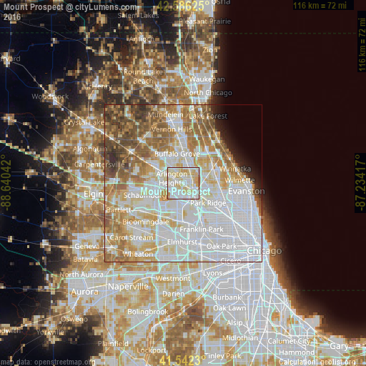
Analysis of Mount Prospect night lights 2016
Square area 10x10 km:
 29.05%
90-99
36.51%80-89
25.87%70-79
8.25%60-69
0.32%50-59
0%40-49
0%30-39
0%20-29
0%10-19
0%0-9
0%Square area 50x50 km:
29.21%90-99
17.49%80-89
9.78%70-79
8.07%60-69
9%50-59
7.45%40-49
4.87%30-39
2.13%20-29
2.14%10-19
1.94%0-9
7.92%Clear (daylight) street map image can be seen on geolist.org.
Map coordinates:
42° 35' 10.5" North, 88° 38' 25.5" West
42° 3' 59.1" North, 87° 56' 14.2" West
41° 32' 32.3" North, 87° 14' 3" West
Some cities around Mount Prospect sort by population:
• Arlington Heights
4.3 km =2.7 mi,  304°
304°
• Palatine
9.4 km =5.8 mi, 301°
• Des Plaines
5.8 km =3.6 mi,  129°
129°
• Buffalo Grove
9.6 km =6 mi,  348°
348°
• Wheeling
8.1 km =5 mi,  4°
4°
• Elk Grove Village
7.5 km =4.7 mi,  201°
201°
• Rolling Meadows
6.6 km =4.1 mi,  287°
287°
• Prospect Heights
3.2 km =2 mi,  359°
359°
4903024 (p: 54,747)
Sources (retrieved 2019-11-25):
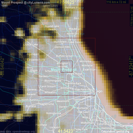
» NASA, Earths city lights 1995
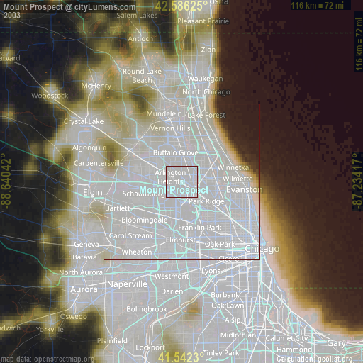
» NASA city lights 2003
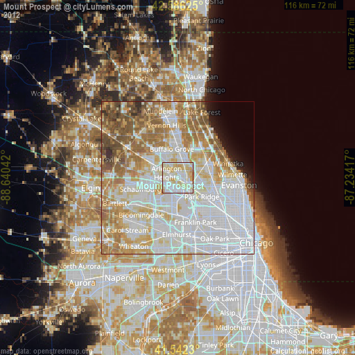
» Earth at Night: Flat Maps 2012, 2016