Denver night lights from space
Night Light of Denver (Colorado) from space (United States) Src. Average luminocity for 10x10km area is 99.8782% and for 50x50km: 65.7884%.


Analysis of Denver night lights 2016
Square area 10x10 km:
 91.07%
90-99
8.93%80-89
0%70-79
0%60-69
0%50-59
0%40-49
0%30-39
0%20-29
0%10-19
0%0-9
0%Square area 50x50 km:
18.35%90-99
15.5%80-89
9.52%70-79
12.24%60-69
8.9%50-59
5.95%40-49
5.07%30-39
4.7%20-29
5.38%10-19
5.51%0-9
8.89%Clear (daylight) street map image can be seen on geolist.org.
Map coordinates:
40° 16' 39.7" North, 105° 41' 16.2" West
39° 44' 20.9" North, 104° 59' 4.9" West
39° 11' 46.9" North, 104° 16' 53.7" West
Fantastic image of Denver from space taken by astronauts [src2], but I don't have information about it's orientation, scale or angle. If necessary, it was rotated manually, so North points approximately to upper direction. Click to zoom in:

Some cities around Denver sort by population:
• Lakewood
9.1 km =5.7 mi,  245°
245°
• Commerce City
8.8 km =5.5 mi,  29°
29°
• Englewood
10.2 km =6.3 mi,  181°
181°
• Wheat Ridge
8.5 km =5.3 mi,  290°
290°
• Berkley
8.1 km =5 mi,  334°
334°
• Twin Lakes
9.7 km =6 mi,  349°
349°
• Edgewater
7 km =4.3 mi,  282°
282°
• Glendale
5.8 km =3.6 mi,  130°
130°
5419384 (p: 682,545)
Sources (retrieved 2019-11-25):
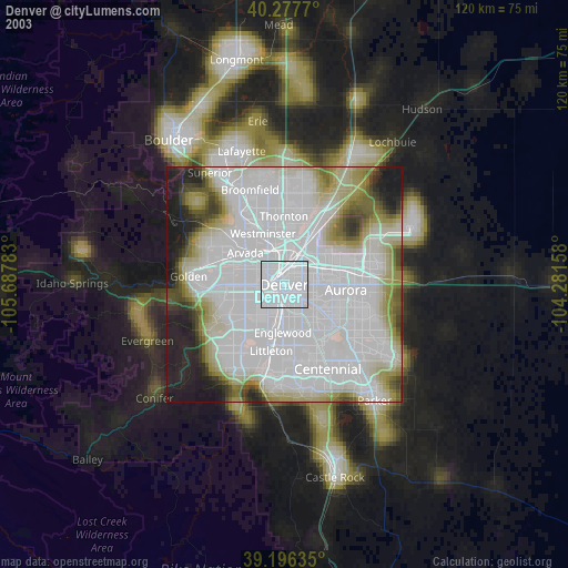
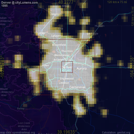
» NASA, Earths city lights 1995
» NASA city lights 2003
» Earth at Night: Flat Maps 2012, 2016
Src.2: NASA: Denver, CO Night Lights