Commerce City night lights from space
Night Light of Commerce City (Colorado) from space (United States) Src. Average luminocity for 10x10km area is 91.6718% and for 50x50km: 65.5434%.
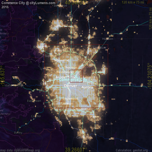
Analysis of Commerce City night lights 2016
Square area 10x10 km:
 53.23%
90-99
18.88%80-89
8.33%70-79
8.67%60-69
6.12%50-59
4.08%40-49
0.68%30-39
0%20-29
0%10-19
0%0-9
0%Square area 50x50 km:
17.67%90-99
14.61%80-89
9.38%70-79
11.93%60-69
9.12%50-59
6.68%40-49
5.91%30-39
5.26%20-29
7%10-19
6.84%0-9
5.61%Clear (daylight) street map image can be seen on geolist.org.
Map coordinates:
40° 20' 46.8" North, 105° 38' 13.2" West
39° 48' 30" North, 104° 56' 1.9" West
39° 15' 57.9" North, 104° 13' 50.7" West
Some cities around Commerce City sort by population:
• Denver
8.8 km =5.5 mi,  209°
209°
• Thornton
7.4 km =4.6 mi,  333°
333°
• Sherrelwood
6.6 km =4.1 mi,  299°
299°
• Welby
3.8 km =2.4 mi, 325°
• Federal Heights
7.3 km =4.5 mi,  310°
310°
• Berkley
7.9 km =4.9 mi,  266°
266°
• Derby
3.7 km =2.3 mi,  20°
20°
• Twin Lakes
6.3 km =3.9 mi,  287°
287°
5417737 (p: 53,696)
Sources (retrieved 2019-11-25):
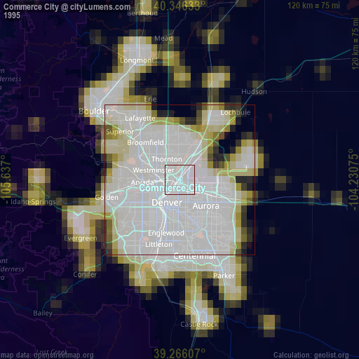
» NASA, Earths city lights 1995
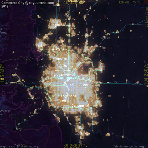
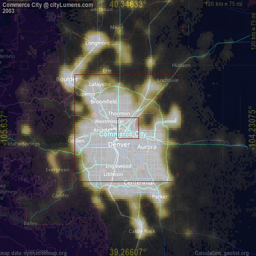
» NASA city lights 2003
» Earth at Night: Flat Maps 2012, 2016