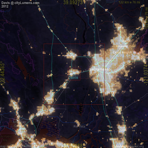
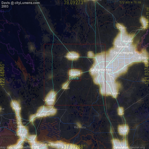
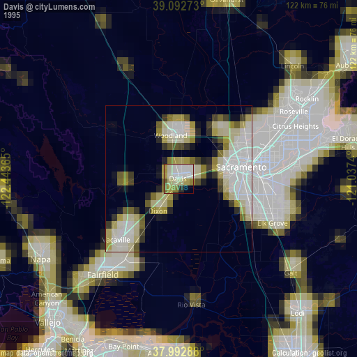
Davis night lights from space
Night Light of Davis (California) from space (United States) Src. Average luminocity for 10x10km area is 38.7695% and for 50x50km: 19.6512%.

Analysis of Davis night lights 2016
Square area 10x10 km:
 6.66%
6.66%90-99
5.68%80-89
3.08%70-79
7.14%60-69
4.06%50-59
6.49%40-49
7.14%30-39
3.25%20-29
7.47%10-19
40.26%0-9
8.77%Square area 50x50 km:
4.25%90-99
4.33%80-89
1.56%70-79
2.9%60-69
2.25%50-59
1.87%40-49
2.21%30-39
1.97%20-29
3.97%10-19
11.33%0-9
63.37%Clear (daylight) street map image can be seen on geolist.org.
Map coordinates:
39° 5' 33.8" North, 122° 26' 37.1" West
38° 32' 41.7" North, 121° 44' 25.9" West
37° 59' 34.4" North, 121° 2' 14.6" West
Some cities around Davis sort by population:
• Sacramento
21.8 km =13.5 mi,  79°
79°
• Woodland
15.1 km =9.4 mi,  349°
349°
• West Sacramento
18.7 km =11.6 mi, 77°
• Florin
29.4 km =18.3 mi,  100°
100°
• Dixon
13.2 km =8.2 mi,  213°
213°
• Parkway
25.1 km =15.6 mi, 102°
• Winters
20.2 km =12.6 mi,  263°
263°
• Fruitridge Pocket
24.8 km =15.4 mi,  93°
93°
5341704 (p: 67,666)
Sources (retrieved 2019-11-25):
» NASA, Earths city lights 1995
» NASA city lights 2003
» Earth at Night: Flat Maps 2012, 2016