Woodland night lights from space
Night Light of Woodland (California) from space (United States) Src. Average luminocity for 10x10km area is 42.7704% and for 50x50km: 12.7961%.
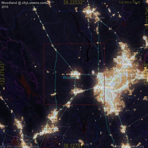
Analysis of Woodland night lights 2016
Square area 10x10 km:
 9.01%
9.01%90-99
8.67%80-89
3.4%70-79
5.1%60-69
7.82%50-59
5.44%40-49
5.27%30-39
1.7%20-29
9.18%10-19
33.84%0-9
10.54%Square area 50x50 km:
2.63%90-99
2.74%80-89
0.95%70-79
1.81%60-69
1.5%50-59
1.11%40-49
1.56%30-39
1.42%20-29
2.68%10-19
8.48%0-9
75.13%Clear (daylight) street map image can be seen on geolist.org.
Map coordinates:
39° 13' 31.2" North, 122° 28' 35.1" West
38° 40' 42.7" North, 121° 46' 23.9" West
38° 7' 39" North, 121° 4' 12.6" West
Some cities around Woodland sort by population:
• Sacramento
26.5 km =16.5 mi,  113°
113°
• Davis
15.1 km =9.4 mi,  169°
169°
• West Sacramento
23.8 km =14.8 mi,  117°
117°
• Dixon
26.3 km =16.3 mi,  189°
189°
• Rio Linda
28.2 km =17.5 mi,  87°
87°
• Winters
24.2 km =15 mi,  225°
225°
• Fruitridge Pocket
32 km =19.9 mi, 120°
• Elverta
27.2 km =16.9 mi,  81°
81°
5410430 (p: 58,567)
Sources (retrieved 2019-11-25):
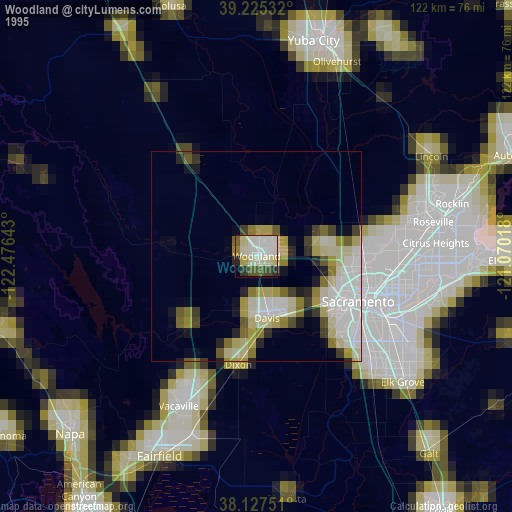
» NASA, Earths city lights 1995
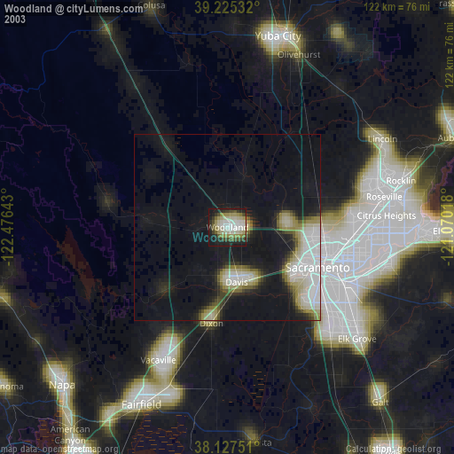
» NASA city lights 2003
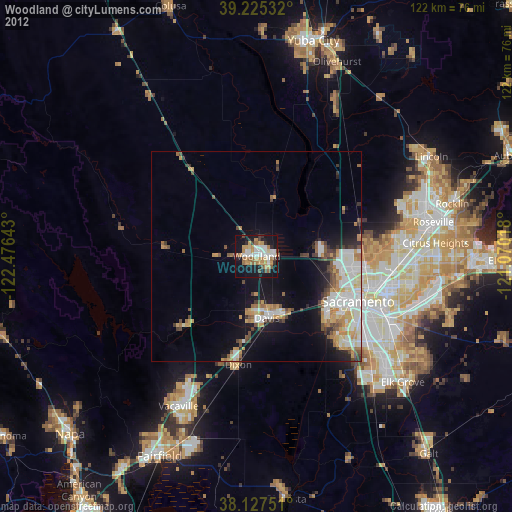
» Earth at Night: Flat Maps 2012, 2016