West Sacramento night lights from space
Night Light of West Sacramento (California) from space (United States) Src. Average luminocity for 10x10km area is 81.7565% and for 50x50km: 39.9707%.
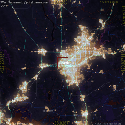

Analysis of West Sacramento night lights 2016
Square area 10x10 km:
 25.81%
90-99
30.36%80-89
8.93%70-79
10.06%60-69
8.93%50-59
2.27%40-49
3.25%30-39
3.73%20-29
6.01%10-19
0.65%0-9
0%Square area 50x50 km:
9.79%90-99
10.82%80-89
4.99%70-79
6.97%60-69
4.58%50-59
2.76%40-49
2.64%30-39
3%20-29
4.83%10-19
11.82%0-9
37.8%Clear (daylight) street map image can be seen on geolist.org.
Map coordinates:
39° 7' 40.8" North, 122° 14' 0.1" West
38° 34' 49.7" North, 121° 31' 48.8" West
38° 1' 43.3" North, 120° 49' 37.6" West
Some cities around West Sacramento sort by population:
• Sacramento
3.1 km =1.9 mi,  87°
87°
• Arden-Arcade
13.4 km =8.3 mi,  79°
79°
• Florin
14.1 km =8.8 mi,  131°
131°
• Rosemont
14.7 km =9.1 mi,  102°
102°
• Rio Linda
14.2 km =8.8 mi,  29°
29°
• Parkway
11.3 km =7 mi,  146°
146°
• La Riviera
15.1 km =9.4 mi, 95°
• Fruitridge Pocket
8.4 km =5.2 mi, 129°
5408211 (p: 52,721)
Sources (retrieved 2019-11-25):
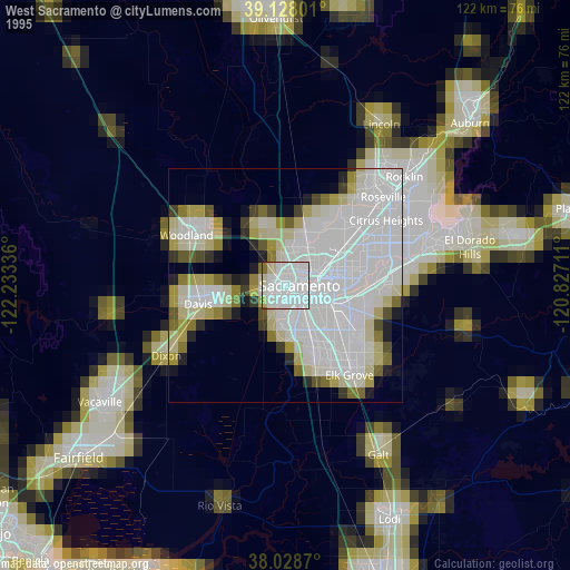
» NASA, Earths city lights 1995
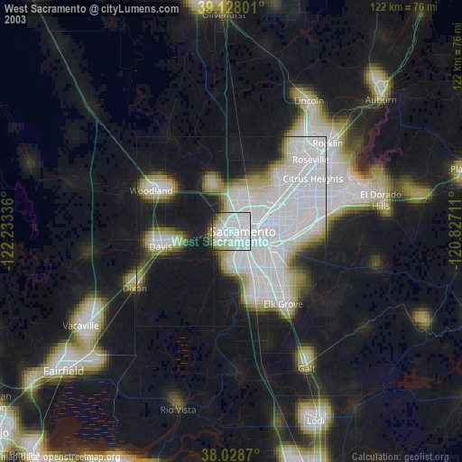
» NASA city lights 2003
» Earth at Night: Flat Maps 2012, 2016