Dalhart night lights from space
Night Light of Dalhart (Texas) from space (United States) Src. Average luminocity for 10x10km area is 22.7106% and for 50x50km: 1.2615%.
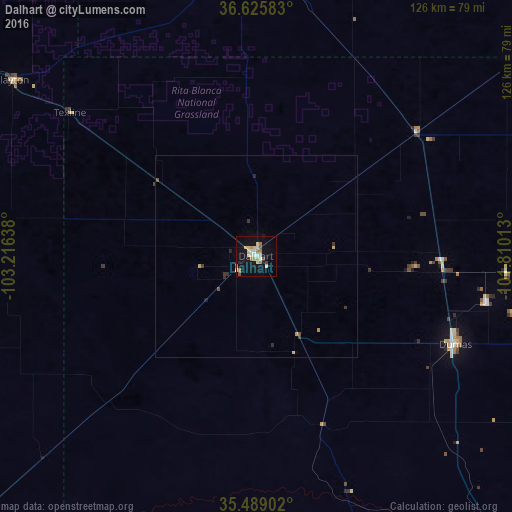
Analysis of Dalhart night lights 2016
Square area 10x10 km:
 0.92%
0.92%90-99
3.11%80-89
8.61%70-79
2.38%60-69
3.66%50-59
1.28%40-49
1.28%30-39
0.73%20-29
0.55%10-19
20.51%0-9
56.96%Square area 50x50 km:
0.03%90-99
0.12%80-89
0.41%70-79
0.16%60-69
0.14%50-59
0.06%40-49
0.15%30-39
0.24%20-29
0.12%10-19
0.82%0-9
97.75%Clear (daylight) street map image can be seen on geolist.org.
Map coordinates:
36° 37' 33" North, 103° 12' 59" West
36° 3' 34.1" North, 102° 30' 47.7" West
35° 29' 20.5" North, 101° 48' 36.5" West
Some cities around Dalhart sort by population:
• Amarillo
111.7 km =69.4 mi,  146°
146°
• Pampa
151.7 km =94.3 mi,  112°
112°
• Hereford
138.7 km =86.2 mi,  175°
175°
• Dumas
53.2 km =33.1 mi, 113°
• Canyon
131.5 km =81.7 mi,  155°
155°
• Borger
109.6 km =68.1 mi, 113°
• Guymon
115.5 km =71.8 mi,  53°
53°
• Tucumcari
147.6 km =91.7 mi,  228°
228°
5519862 (p: 8,370)
Sources (retrieved 2019-11-25):
» Earth at Night: Flat Maps 2012, 2016