Amarillo night lights from space
Night Light of Amarillo (Texas) from space (United States) Src. Average luminocity for 10x10km area is 81.9563% and for 50x50km: 15.9987%.
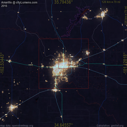

Analysis of Amarillo night lights 2016
Square area 10x10 km:
 26.05%
90-99
27.1%80-89
10.14%70-79
7.52%60-69
11.19%50-59
6.29%40-49
6.12%30-39
5.42%20-29
0.17%10-19
0%0-9
0%Square area 50x50 km:
2.47%90-99
2.78%80-89
2.33%70-79
1.73%60-69
2.55%50-59
1.78%40-49
2.53%30-39
3.25%20-29
3.77%10-19
7.32%0-9
69.49%Clear (daylight) street map image can be seen on geolist.org.
Map coordinates:
35° 47' 39.7" North, 102° 32' 3.9" West
35° 13' 19.2" North, 101° 49' 52.7" West
34° 38' 44.1" North, 101° 7' 41.4" West
Some cities around Amarillo sort by population:
• Plainview
115.9 km =72 mi,  174°
174°
• Pampa
86.4 km =53.7 mi,  66°
66°
• Hereford
68.7 km =42.7 mi,  228°
228°
• Dumas
72.7 km =45.2 mi,  349°
349°
• Canyon
28 km =17.4 mi,  196°
196°
• Borger
63.3 km =39.3 mi,  38°
38°
• Dalhart
111.7 km =69.4 mi,  326°
326°
• Muleshoe
137.5 km =85.4 mi,  216°
216°
5516233 (p: 198,645)
Sources (retrieved 2019-11-25):
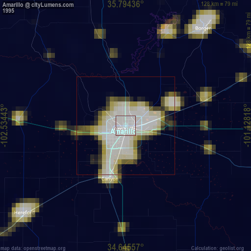
» NASA, Earths city lights 1995
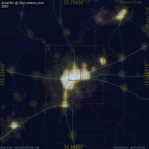
» NASA city lights 2003
» Earth at Night: Flat Maps 2012, 2016