Hereford night lights from space
Night Light of Hereford (Texas) from space (United States) Src. Average luminocity for 10x10km area is 36.1612% and for 50x50km: 2.5193%.
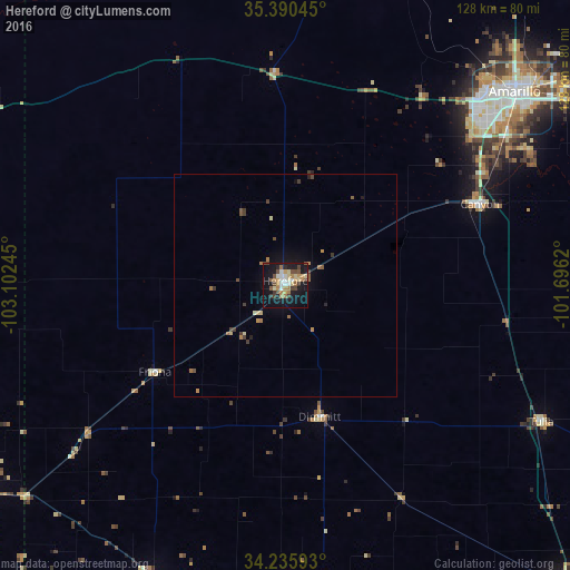
Analysis of Hereford night lights 2016
Square area 10x10 km:
 3.11%
3.11%90-99
5.13%80-89
6.59%70-79
4.95%60-69
7.69%50-59
2.56%40-49
8.06%30-39
4.03%20-29
3.3%10-19
40.66%0-9
13.92%Square area 50x50 km:
0.12%90-99
0.21%80-89
0.42%70-79
0.33%60-69
0.56%50-59
0.25%40-49
0.54%30-39
0.47%20-29
0.21%10-19
2.04%0-9
94.87%Clear (daylight) street map image can be seen on geolist.org.
Map coordinates:
35° 23' 25.6" North, 103° 6' 8.8" West
34° 48' 54.8" North, 102° 23' 57.6" West
34° 14' 9.3" North, 101° 41' 46.3" West
Some cities around Hereford sort by population:
• Amarillo
68.7 km =42.7 mi,  48°
48°
• Clovis
86.7 km =53.9 mi,  238°
238°
• Plainview
94.6 km =58.8 mi,  137°
137°
• Dumas
123 km =76.4 mi,  18°
18°
• Canyon
47.5 km =29.5 mi,  67°
67°
• Portales
110.6 km =68.7 mi,  230°
230°
• Littlefield
100.1 km =62.2 mi,  176°
176°
• Muleshoe
71.9 km =44.7 mi,  204°
204°
5523074 (p: 15,021)
Sources (retrieved 2019-11-25):
» Earth at Night: Flat Maps 2012, 2016