Borger night lights from space
Night Light of Borger (Texas) from space (United States) Src. Average luminocity for 10x10km area is 37.2587% and for 50x50km: 2.8164%.
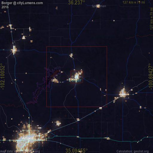
Analysis of Borger night lights 2016
Square area 10x10 km:
 4.9%
4.9%90-99
4.72%80-89
6.99%70-79
7.52%60-69
5.94%50-59
2.45%40-49
2.1%30-39
5.77%20-29
7.52%10-19
41.26%0-9
10.84%Square area 50x50 km:
0.19%90-99
0.21%80-89
0.56%70-79
0.44%60-69
0.46%50-59
0.31%40-49
0.28%30-39
0.55%20-29
0.59%10-19
2.1%0-9
94.31%Clear (daylight) street map image can be seen on geolist.org.
Map coordinates:
36° 14' 13.2" North, 102° 6' 1.9" West
35° 40' 4.2" North, 101° 23' 50.6" West
35° 5' 40.4" North, 100° 41' 39.4" West
Some cities around Borger sort by population:
• Amarillo
63.3 km =39.3 mi,  218°
218°
• Pampa
42.2 km =26.2 mi,  110°
110°
• Hereford
131.4 km =81.6 mi, 223°
• Dumas
56.4 km =35 mi,  292°
292°
• Canyon
89.9 km =55.9 mi,  211°
211°
• Guymon
113.1 km =70.3 mi,  356°
356°
• Perryton
97.4 km =60.5 mi,  33°
33°
• Dalhart
109.6 km =68.1 mi, 293°
5517469 (p: 12,964)
Sources (retrieved 2019-11-25):
» Earth at Night: Flat Maps 2012, 2016