Floresville night lights from space
Night Light of Floresville (Texas) from space (United States) Src. Average luminocity for 10x10km area is 20.6607% and for 50x50km: 6.7229%.
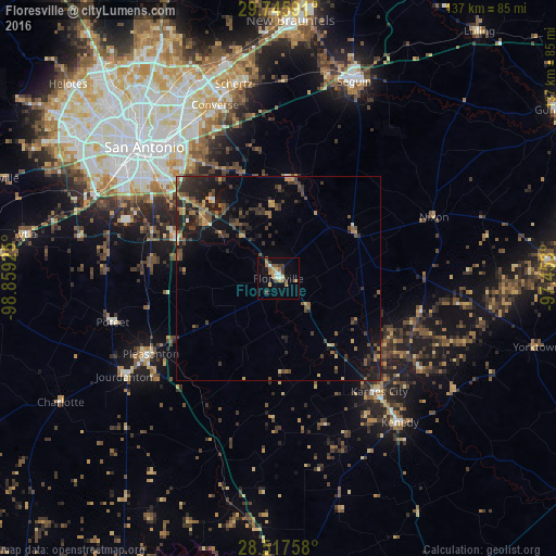
Analysis of Floresville night lights 2016
Square area 10x10 km:
 1.59%
1.59%90-99
2.38%80-89
2.98%70-79
3.37%60-69
4.56%50-59
2.98%40-49
2.58%30-39
3.77%20-29
0%10-19
9.72%0-9
66.07%Square area 50x50 km:
0.18%90-99
0.24%80-89
0.54%70-79
0.85%60-69
0.96%50-59
1.42%40-49
1.42%30-39
2.31%20-29
2.72%10-19
4.92%0-9
84.42%Clear (daylight) street map image can be seen on geolist.org.
Map coordinates:
29° 44' 45.3" North, 98° 51' 33.3" West
29° 8' 0.9" North, 98° 9' 22" West
28° 31' 3.3" North, 97° 27' 10.8" West
Some cities around Floresville sort by population:
• San Antonio
46 km =28.6 mi,  314°
314°
• Schertz
47.8 km =29.7 mi,  346°
346°
• Converse
45.5 km =28.3 mi,  340°
340°
• Universal City
47.9 km =29.8 mi, 344°
• Pleasanton
36.4 km =22.6 mi,  239°
239°
• Kirby
42.9 km =26.7 mi,  328°
328°
• Windcrest
47.7 km =29.6 mi, 332°
• Terrell Hills
47.5 km =29.5 mi,  323°
323°
4691553 (p: 7,321)
Sources (retrieved 2019-11-25):
» Earth at Night: Flat Maps 2012, 2016