Crete night lights from space
Night Light of Crete (Illinois) from space (United States) Src. Average luminocity for 10x10km area is 57.1276% and for 50x50km: 49.6423%.
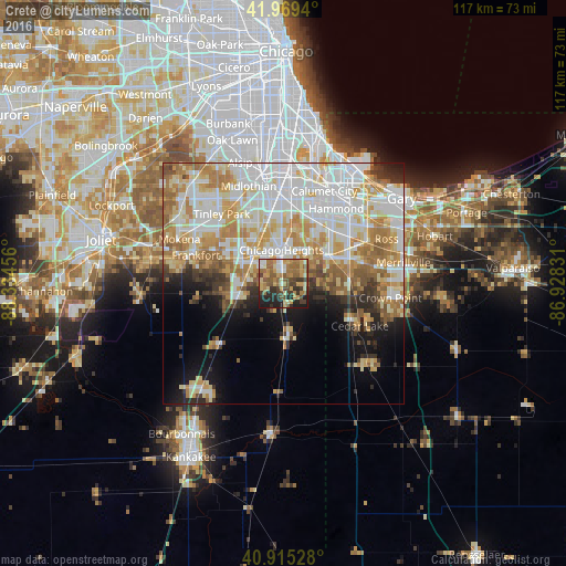
Analysis of Crete night lights 2016
Square area 10x10 km:
 2.89%
2.89%90-99
7.31%80-89
10.03%70-79
13.27%60-69
17.35%50-59
12.07%40-49
8.16%30-39
9.35%20-29
12.76%10-19
6.8%0-9
0%Square area 50x50 km:
13.76%90-99
11.86%80-89
7.5%70-79
7.6%60-69
7.7%50-59
4.49%40-49
2.43%30-39
3.21%20-29
4.11%10-19
7.28%0-9
30.06%Clear (daylight) street map image can be seen on geolist.org.
Map coordinates:
41° 58' 9.8" North, 88° 20' 4.4" West
41° 26' 40.1" North, 87° 37' 53.1" West
40° 54' 55" North, 86° 55' 41.9" West
Some cities around Crete sort by population:
• Chicago Heights
6.9 km =4.3 mi,  357°
357°
• Park Forest
6.3 km =3.9 mi,  325°
325°
• Matteson
9.5 km =5.9 mi,  314°
314°
• Richton Park
7.5 km =4.7 mi, 306°
• Sauk Village
7.2 km =4.5 mi,  47°
47°
• Steger
2.9 km =1.8 mi,  351°
351°
• University Park
4.4 km =2.7 mi,  267°
267°
• Monee
9.6 km =6 mi,  253°
253°
4889120 (p: 8,191)
Sources (retrieved 2019-11-25):
» Earth at Night: Flat Maps 2012, 2016