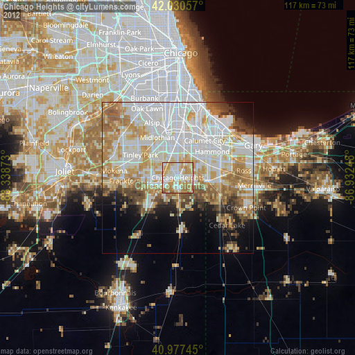
Chicago Heights night lights from space
Night Light of Chicago Heights (Illinois) from space (United States) Src. Average luminocity for 10x10km area is 84.4541% and for 50x50km: 57.3217%.

Analysis of Chicago Heights night lights 2016
Square area 10x10 km:
 21.09%
90-99
25.17%80-89
12.76%70-79
20.92%60-69
15.82%50-59
3.91%40-49
0.34%30-39
0%20-29
0%10-19
0%0-9
0%Square area 50x50 km:
18.49%90-99
13.55%80-89
7.58%70-79
7.8%60-69
8.24%50-59
5.36%40-49
3.19%30-39
3.32%20-29
4.17%10-19
6.95%0-9
21.34%Clear (daylight) street map image can be seen on geolist.org.
Map coordinates:
42° 1' 50.1" North, 88° 20' 19.4" West
41° 30' 22.1" North, 87° 38' 8.2" West
40° 58' 38.8" North, 86° 55' 56.9" West
Some cities around Chicago Heights sort by population:
• Park Forest
3.6 km =2.2 mi,  243°
243°
• Homewood
6.2 km =3.9 mi,  336°
336°
• Matteson
6.5 km =4 mi,  267°
267°
• Richton Park
6.1 km =3.8 mi,  246°
246°
• Sauk Village
6 km =3.7 mi,  109°
109°
• Steger
4 km =2.5 mi,  180°
180°
• Flossmoor
5.8 km =3.6 mi,  314°
314°
• Glenwood
4.9 km =3 mi,  34°
34°
4887442 (p: 30,284)
Sources (retrieved 2019-11-25):
» Earth at Night: Flat Maps 2012, 2016