Crestwood night lights from space
Night Light of Crestwood (Illinois) from space (United States) Src. Average luminocity for 10x10km area is 92.7549% and for 50x50km: 78.0031%.
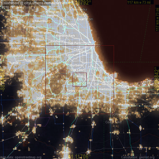
Analysis of Crestwood night lights 2016
Square area 10x10 km:
 39.77%
90-99
33.12%80-89
12.82%70-79
6.17%60-69
8.12%50-59
0%40-49
0%30-39
0%20-29
0%10-19
0%0-9
0%Square area 50x50 km:
32.99%90-99
17.95%80-89
9.34%70-79
8.82%60-69
8.94%50-59
6.87%40-49
3.25%30-39
2.61%20-29
2.83%10-19
2.69%0-9
3.7%Clear (daylight) street map image can be seen on geolist.org.
Map coordinates:
42° 10' 4.5" North, 88° 26' 40.8" West
41° 38' 40.7" North, 87° 44' 29.5" West
41° 7' 1.4" North, 87° 2' 18.3" West
Some cities around Crestwood sort by population:
• Oak Forest
4.7 km =2.9 mi,  182°
182°
• Blue Island
5.3 km =3.3 mi,  74°
74°
• Alsip
2.7 km =1.7 mi,  5°
5°
• Mount Greenwood
6.5 km =4 mi,  24°
24°
• Midlothian
2.9 km =1.8 mi,  137°
137°
• Palos Heights
5.3 km =3.3 mi,  299°
299°
• Posen
5.2 km =3.2 mi,  106°
106°
• Robbins
3.1 km =1.9 mi,  91°
91°
4889113 (p: 10,984)
Sources (retrieved 2019-11-25):
» Earth at Night: Flat Maps 2012, 2016