Palos Heights night lights from space
Night Light of Palos Heights (Illinois) from space (United States) Src. Average luminocity for 10x10km area is 86.3182% and for 50x50km: 82.6975%.
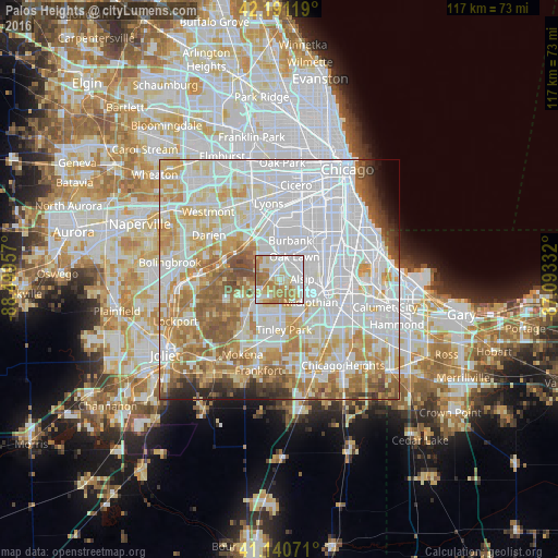
Analysis of Palos Heights night lights 2016
Square area 10x10 km:
 27.27%
90-99
25.97%80-89
11.85%70-79
12.34%60-69
21.43%50-59
1.14%40-49
0%30-39
0%20-29
0%10-19
0%0-9
0%Square area 50x50 km:
35.33%90-99
19.43%80-89
10.46%70-79
10.28%60-69
9.18%50-59
6.36%40-49
2.66%30-39
1.89%20-29
2.03%10-19
1.07%0-9
1.31%Clear (daylight) street map image can be seen on geolist.org.
Map coordinates:
42° 11' 28.3" North, 88° 29' 58.5" West
41° 40' 5.1" North, 87° 47' 47.2" West
41° 8' 26.6" North, 87° 5' 36" West
Some cities around Palos Heights sort by population:
• Orland Park
6.4 km =4 mi,  228°
228°
• Oak Lawn
5.7 km =3.5 mi,  33°
33°
• Burbank
7.5 km =4.7 mi,  10°
10°
• Alsip
4.8 km =3 mi,  88°
88°
• Chicago Ridge
4 km =2.5 mi,  21°
21°
• Hickory Hills
6.8 km =4.2 mi,  339°
339°
• Crestwood
5.3 km =3.3 mi,  119°
119°
• Worth
2.4 km =1.5 mi,  358°
358°
4905259 (p: 12,545)
Sources (retrieved 2019-11-25):
» Earth at Night: Flat Maps 2012, 2016