Corona night lights from space
Night Light of Corona (New York) from space (United States) Src. Average luminocity for 10x10km area is 99.6916% and for 50x50km: 77.475%.
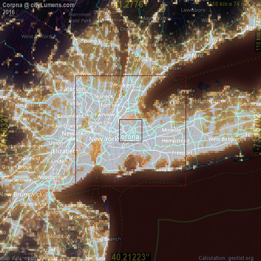
Analysis of Corona night lights 2016
Square area 10x10 km:
 84.25%
90-99
15.42%80-89
0.32%70-79
0%60-69
0%50-59
0%40-49
0%30-39
0%20-29
0%10-19
0%0-9
0%Square area 50x50 km:
43.37%90-99
16.99%80-89
5.18%70-79
5.69%60-69
4.75%50-59
3.06%40-49
2.54%30-39
2.48%20-29
4.47%10-19
6.21%0-9
5.26%Clear (daylight) street map image can be seen on geolist.org.
Map coordinates:
41° 16' 39.4" North, 74° 33' 47.8" West
40° 44' 49.4" North, 73° 51' 36.5" West
40° 12' 44" North, 73° 9' 25.3" West
Some cities around Corona sort by population:
• Elmhurst
1.9 km =1.2 mi,  231°
231°
• Forest Hills
3.5 km =2.2 mi,  166°
166°
• Jackson Heights
2.3 km =1.4 mi,  294°
294°
• Rego Park
2.4 km =1.5 mi,  164°
164°
• Woodside
3.8 km =2.4 mi,  267°
267°
• Kew Gardens Hills
3.6 km =2.2 mi,  121°
121°
• Middle Village
3.8 km =2.4 mi,  207°
207°
• East Elmhurst
1.6 km =1 mi,  345°
345°
5113779 (p: 109,698)
Sources (retrieved 2019-11-25):
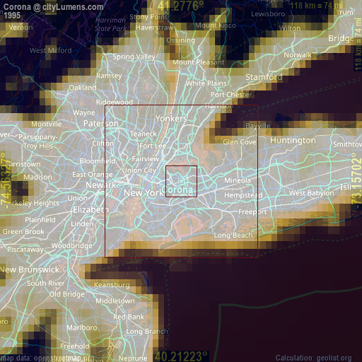
» NASA, Earths city lights 1995
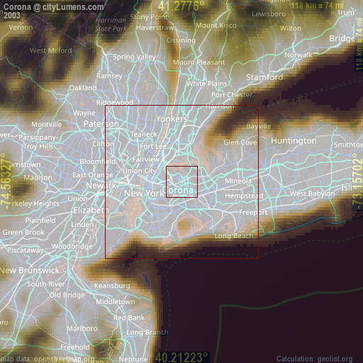
» NASA city lights 2003
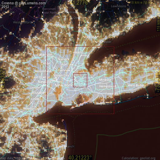
» Earth at Night: Flat Maps 2012, 2016