Conroe night lights from space
Night Light of Conroe (Texas) from space (United States) Src. Average luminocity for 10x10km area is 78.6923% and for 50x50km: 41.508%.

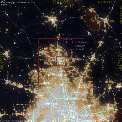
Analysis of Conroe night lights 2016
Square area 10x10 km:
 18.5%
18.5%90-99
20.88%80-89
11.72%70-79
8.06%60-69
22.89%50-59
12.45%40-49
4.21%30-39
1.28%20-29
0%10-19
0%0-9
0%Square area 50x50 km:
3.44%90-99
4.69%80-89
6.47%70-79
7.07%60-69
9.15%50-59
10.66%40-49
10.84%30-39
8.28%20-29
6.48%10-19
8.84%0-9
24.09%Clear (daylight) street map image can be seen on geolist.org.
Map coordinates:
30° 55' 1.2" North, 96° 9' 33" West
30° 18' 42.8" North, 95° 27' 21.8" West
29° 42' 10.8" North, 94° 45' 10.5" West
Some cities around Conroe sort by population:
• The Woodlands
17.4 km =10.8 mi,  190°
190°
• Atascocita
44 km =27.3 mi,  142°
142°
• Spring
26.1 km =16.2 mi,  171°
171°
• Aldine
42.8 km =26.6 mi, 170°
• Humble
39.5 km =24.5 mi,  151°
151°
• Tomball
28.4 km =17.6 mi,  212°
212°
• Cleveland
35.7 km =22.2 mi,  84°
84°
• Willis
12.8 km =8 mi,  349°
349°
4682991 (p: 68,602)
Sources (retrieved 2019-11-25):
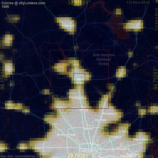
» NASA, Earths city lights 1995
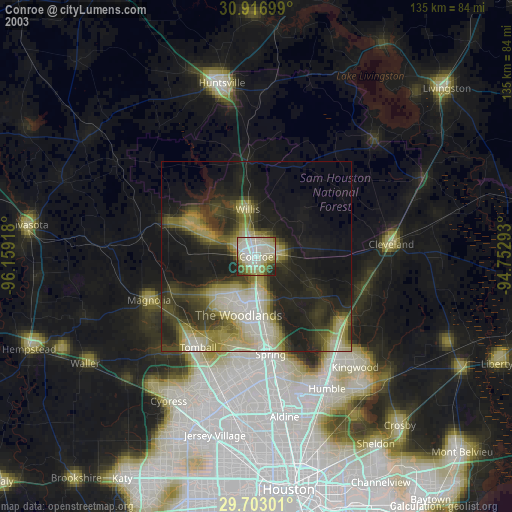
» NASA city lights 2003
» Earth at Night: Flat Maps 2012, 2016