The Woodlands night lights from space
Night Light of The Woodlands (Texas) from space (United States) Src. Average luminocity for 10x10km area is 86.1709% and for 50x50km: 65.188%.
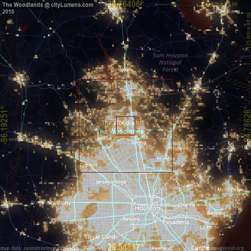
Analysis of The Woodlands night lights 2016
Square area 10x10 km:
 21.09%
90-99
25.82%80-89
13.64%70-79
31.27%60-69
8%50-59
0.18%40-49
0%30-39
0%20-29
0%10-19
0%0-9
0%Square area 50x50 km:
13.28%90-99
14.77%80-89
9.79%70-79
10.28%60-69
11.1%50-59
10.42%40-49
9.68%30-39
7.24%20-29
4.48%10-19
4.94%0-9
4.01%Clear (daylight) street map image can be seen on geolist.org.
Map coordinates:
30° 45' 50.6" North, 96° 11' 33" West
30° 9' 28.8" North, 95° 29' 21.8" West
29° 32' 53.4" North, 94° 47' 10.5" West
Some cities around The Woodlands sort by population:
• Conroe
17.4 km =10.8 mi,  10°
10°
• Spring
11.1 km =6.9 mi,  141°
141°
• Cypress
29 km =18 mi,  223°
223°
• Aldine
27.2 km =16.9 mi,  157°
157°
• Humble
28.1 km =17.5 mi,  128°
128°
• Tomball
13.9 km =8.6 mi,  240°
240°
• Jersey Village
30.9 km =19.2 mi,  193°
193°
• Willis
29.7 km =18.5 mi,  1°
1°
4736476 (p: 93,847)
Sources (retrieved 2019-11-25):
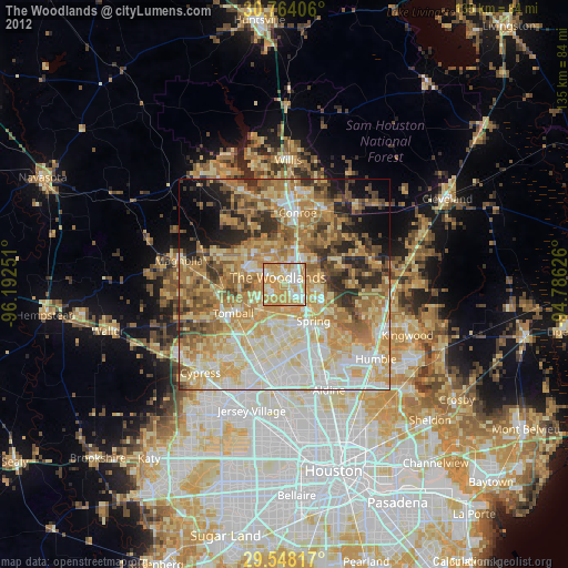
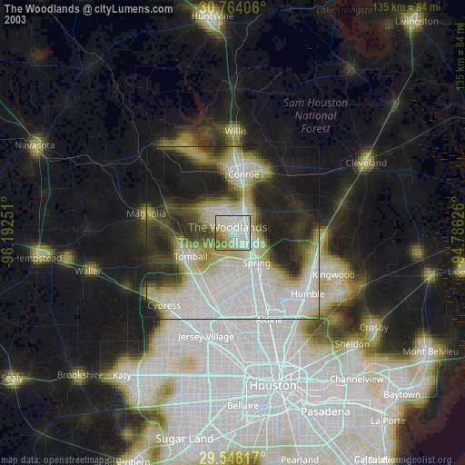
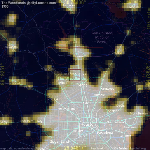
» NASA, Earths city lights 1995
» NASA city lights 2003
» Earth at Night: Flat Maps 2012, 2016