Spring night lights from space
Night Light of Spring (Texas) from space (United States) Src. Average luminocity for 10x10km area is 90.1042% and for 50x50km: 73.4152%.
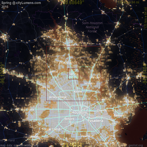
Analysis of Spring night lights 2016
Square area 10x10 km:
 28.22%
90-99
33.33%80-89
16.67%70-79
12.88%60-69
8.52%50-59
0.38%40-49
0%30-39
0%20-29
0%10-19
0%0-9
0%Square area 50x50 km:
19.44%90-99
19.55%80-89
10.11%70-79
10.96%60-69
11.6%50-59
8.69%40-49
6.91%30-39
4.98%20-29
3.2%10-19
2.87%0-9
1.7%Clear (daylight) street map image can be seen on geolist.org.
Map coordinates:
30° 41' 11.4" North, 96° 7' 13" West
30° 4' 47.8" North, 95° 25' 1.8" West
29° 28' 10.7" North, 94° 42' 50.5" West
Some cities around Spring sort by population:
• The Woodlands
11.1 km =6.9 mi,  321°
321°
• Conroe
26.1 km =16.2 mi,  351°
351°
• Atascocita
24.8 km =15.4 mi,  111°
111°
• Cypress
29.6 km =18.4 mi,  245°
245°
• Aldine
16.8 km =10.4 mi,  167°
167°
• Humble
17.4 km =10.8 mi,  121°
121°
• Tomball
19.2 km =11.9 mi,  275°
275°
• Jersey Village
25.6 km =15.9 mi,  213°
213°
4733624 (p: 54,298)
Sources (retrieved 2019-11-25):
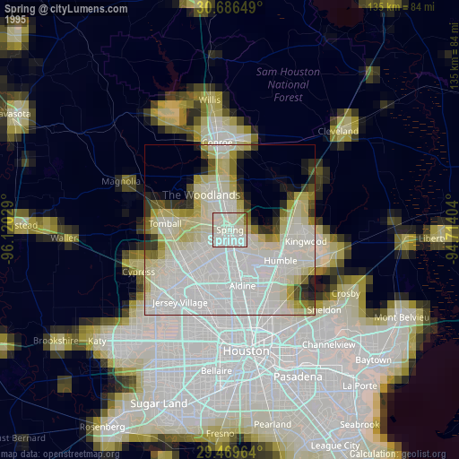
» NASA, Earths city lights 1995
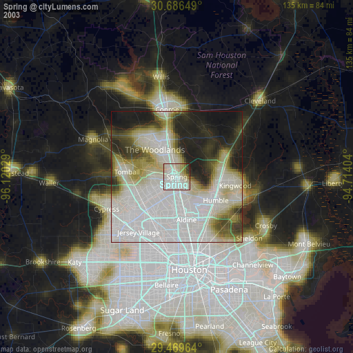
» NASA city lights 2003
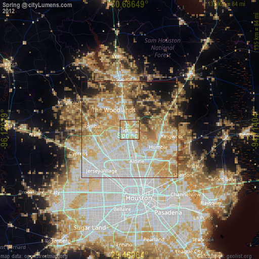
» Earth at Night: Flat Maps 2012, 2016