Atascocita night lights from space
Night Light of Atascocita (Texas) from space (United States) Src. Average luminocity for 10x10km area is 74.4621% and for 50x50km: 59.8908%.
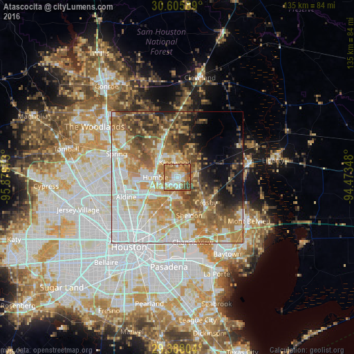
Analysis of Atascocita night lights 2016
Square area 10x10 km:
 12.12%
90-99
17.99%80-89
8.14%70-79
12.31%60-69
27.65%50-59
11.93%40-49
7.01%30-39
2.84%20-29
0%10-19
0%0-9
0%Square area 50x50 km:
15.87%90-99
11.08%80-89
8.33%70-79
9.35%60-69
11.66%50-59
8.14%40-49
7.41%30-39
5.6%20-29
3.5%10-19
6.01%0-9
13.05%Clear (daylight) street map image can be seen on geolist.org.
Map coordinates:
30° 36' 21.2" North, 95° 52' 47" West
29° 59' 55.8" North, 95° 10' 35.8" West
29° 23' 16.9" North, 94° 28' 24.5" West
Some cities around Atascocita sort by population:
• Spring
24.8 km =15.4 mi,  291°
291°
• Channelview
25.5 km =15.8 mi,  166°
166°
• Cloverleaf
24.5 km =15.2 mi,  178°
178°
• Aldine
21 km =13 mi,  249°
249°
• Humble
8.2 km =5.1 mi,  270°
270°
• Jacinto City
26.3 km =16.3 mi,  192°
192°
• Dayton
28.6 km =17.8 mi,  79°
79°
• Highlands
23.1 km =14.4 mi,  149°
149°
4671524 (p: 65,844)
Sources (retrieved 2019-11-25):
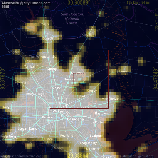
» NASA, Earths city lights 1995
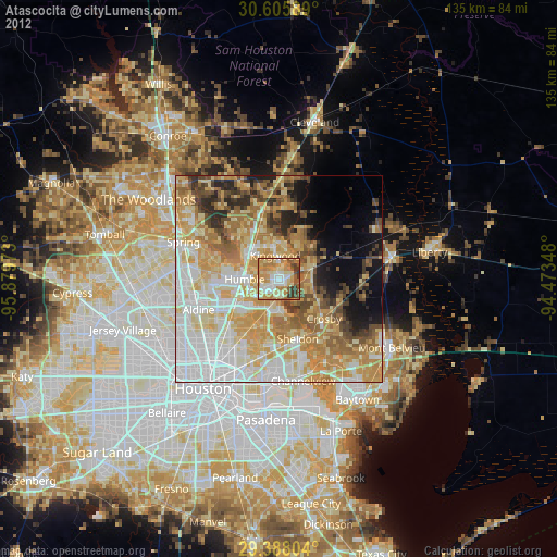
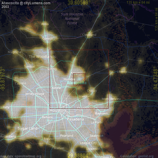
» NASA city lights 2003
» Earth at Night: Flat Maps 2012, 2016