Columbia night lights from space
Night Light of Columbia (Pennsylvania) from space (United States) Src. Average luminocity for 10x10km area is 28.3929% and for 50x50km: 28.9774%.
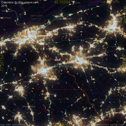
Analysis of Columbia night lights 2016
Square area 10x10 km:
 1.79%
1.79%90-99
2.11%80-89
4.22%70-79
2.92%60-69
4.22%50-59
3.41%40-49
5.84%30-39
4.55%20-29
10.23%10-19
50.65%0-9
10.06%Square area 50x50 km:
3.74%90-99
3.91%80-89
4.06%70-79
3.89%60-69
5.05%50-59
4.43%40-49
4.23%30-39
4.95%20-29
9.21%10-19
19.35%0-9
37.18%Clear (daylight) street map image can be seen on geolist.org.
Map coordinates:
40° 34' 11.8" North, 77° 12' 27.1" West
40° 2' 1.4" North, 76° 30' 15.9" West
39° 29' 35.6" North, 75° 48' 4.6" West
Some cities around Columbia sort by population:
• Lancaster
16.9 km =10.5 mi,  88°
88°
• York
20.6 km =12.8 mi,  247°
247°
• Elizabethtown
15.7 km =9.8 mi,  327°
327°
• East York
16.9 km =10.5 mi, 246°
• Millersville
13.4 km =8.3 mi,  107°
107°
• Mount Joy
8.5 km =5.3 mi,  0°
0°
• Willow Street
20.3 km =12.6 mi, 107°
• Red Lion
17.1 km =10.6 mi,  210°
210°
5185029 (p: 10,388)
Sources (retrieved 2019-11-25):
» Earth at Night: Flat Maps 2012, 2016