Lancaster night lights from space
Night Light of Lancaster (Pennsylvania) from space (United States) Src. Average luminocity for 10x10km area is 78.8718% and for 50x50km: 21.853%.
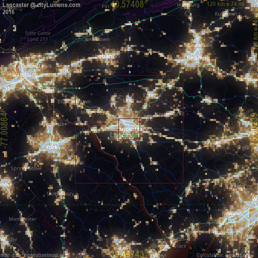
Analysis of Lancaster night lights 2016
Square area 10x10 km:
 23.21%
90-99
19.48%80-89
11.53%70-79
11.53%60-69
13.31%50-59
9.25%40-49
7.14%30-39
3.9%20-29
0.65%10-19
0%0-9
0%Square area 50x50 km:
2.07%90-99
2.54%80-89
3.73%70-79
2.8%60-69
3.33%50-59
2.95%40-49
3.13%30-39
3.95%20-29
6.9%10-19
19.8%0-9
48.81%Clear (daylight) street map image can be seen on geolist.org.
Map coordinates:
40° 34' 26.7" North, 77° 0' 31.1" West
40° 2' 16.4" North, 76° 18' 19.8" West
39° 29' 50.7" North, 75° 36' 8.6" West
Some cities around Lancaster sort by population:
• Ephrata
19.1 km =11.9 mi,  34°
34°
• Columbia
16.9 km =10.5 mi,  268°
268°
• Lititz
13.3 km =8.3 mi,  359°
359°
• Millersville
6.1 km =3.8 mi,  222°
222°
• Mount Joy
18.6 km =11.6 mi,  295°
295°
• Willow Street
7 km =4.3 mi,  159°
159°
• Leola
11.7 km =7.3 mi,  61°
61°
• New Holland
20 km =12.4 mi,  69°
69°
5197079 (p: 59,339)
Sources (retrieved 2019-11-25):
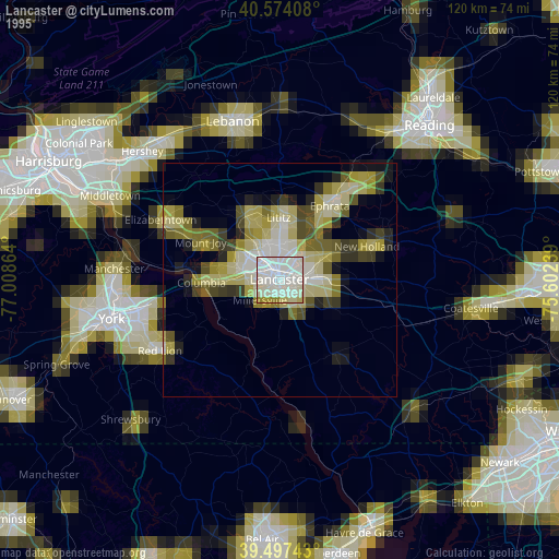
» NASA, Earths city lights 1995
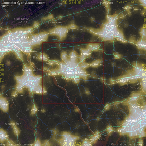
» NASA city lights 2003
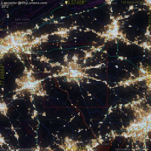
» Earth at Night: Flat Maps 2012, 2016