Clinton night lights from space
Night Light of Clinton (North Carolina) from space (United States) Src. Average luminocity for 10x10km area is 41.4038% and for 50x50km: 5.2124%.
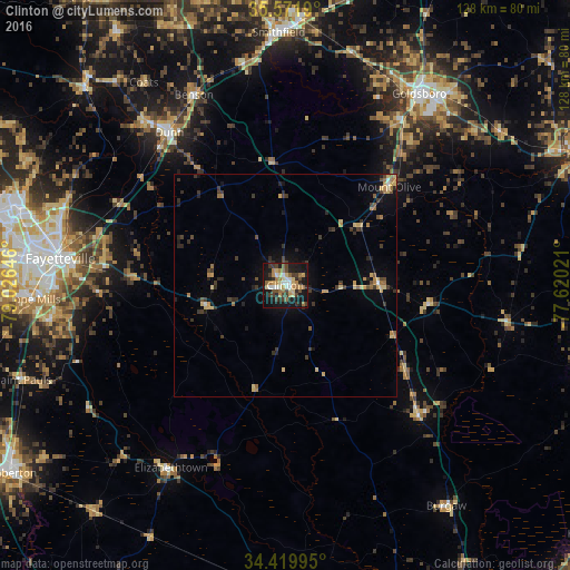
Analysis of Clinton night lights 2016
Square area 10x10 km:
 4.2%
4.2%90-99
5.42%80-89
7.34%70-79
4.55%60-69
11.19%50-59
2.27%40-49
7.87%30-39
8.57%20-29
7.69%10-19
36.36%0-9
4.55%Square area 50x50 km:
0.2%90-99
0.3%80-89
1.03%70-79
0.7%60-69
1.01%50-59
0.39%40-49
0.81%30-39
1.48%20-29
1.22%10-19
3.15%0-9
89.71%Clear (daylight) street map image can be seen on geolist.org.
Map coordinates:
35° 34' 18.8" North, 79° 1' 35.3" West
34° 59' 52.6" North, 78° 19' 24" West
34° 25' 11.8" North, 77° 37' 12.8" West
Some cities around Clinton sort by population:
• Fayetteville
50.9 km =31.6 mi,  276°
276°
• Goldsboro
52.5 km =32.6 mi,  34°
34°
• Fort Bragg
64.1 km =39.8 mi, 284°
• Hope Mills
56.7 km =35.2 mi,  266°
266°
• Spring Lake
62 km =38.5 mi,  287°
287°
• Smithfield
56.8 km =35.3 mi,  358°
358°
• Dunn
43 km =26.7 mi,  322°
322°
• Selma
60 km =37.3 mi,  3°
3°
4461101 (p: 8,767)
Sources (retrieved 2019-11-25):
» Earth at Night: Flat Maps 2012, 2016