Temple Hills night lights from space
Night Light of Temple Hills (Maryland) from space (United States) Src. Average luminocity for 10x10km area is 92.5612% and for 50x50km: 64.7617%.
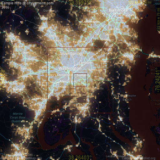
Analysis of Temple Hills night lights 2016
Square area 10x10 km:
 32.31%
90-99
38.78%80-89
14.12%70-79
10.54%60-69
4.25%50-59
0%40-49
0%30-39
0%20-29
0%10-19
0%0-9
0%Square area 50x50 km:
20.78%90-99
14.43%80-89
9.9%70-79
10.4%60-69
7.6%50-59
6.16%40-49
3.82%30-39
4.63%20-29
4.71%10-19
6.54%0-9
11.04%Clear (daylight) street map image can be seen on geolist.org.
Map coordinates:
39° 21' 35.1" North, 77° 38' 55.2" West
38° 48' 50.4" North, 76° 56' 43.9" West
38° 15' 50.5" North, 76° 14' 32.7" West
Some cities around Temple Hills sort by population:
• Oxon Hill-Glassmanor
3.2 km =2 mi,  232°
232°
• Suitland-Silver Hill
4 km =2.5 mi,  24°
24°
• Suitland
4.3 km =2.7 mi,  25°
25°
• Camp Springs
3.5 km =2.2 mi,  108°
108°
• Oxon Hill
4 km =2.5 mi,  252°
252°
• Hillcrest Heights
2.4 km =1.5 mi,  330°
330°
• Silver Hill
3.1 km =1.9 mi,  359°
359°
• Marlow Heights
2.2 km =1.4 mi,  346°
346°
4371053 (p: 7,852)
Sources (retrieved 2019-11-25):
» Earth at Night: Flat Maps 2012, 2016