Clearwater night lights from space
Night Light of Clearwater (Florida) from space (United States) Src. Average luminocity for 10x10km area is 78.0795% and for 50x50km: 41.197%.
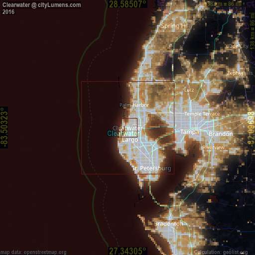
Analysis of Clearwater night lights 2016
Square area 10x10 km:
 26.89%
90-99
28.41%80-89
9.66%70-79
2.84%60-69
6.82%50-59
4.92%40-49
6.82%30-39
2.08%20-29
7.77%10-19
3.79%0-9
0%Square area 50x50 km:
13.64%90-99
9.78%80-89
4.52%70-79
4.17%60-69
6.75%50-59
3.7%40-49
3.32%30-39
2.85%20-29
5.67%10-19
4.64%0-9
40.95%Clear (daylight) street map image can be seen on geolist.org.
Map coordinates:
28° 35' 6.3" North, 83° 30' 11.6" West
27° 57' 57.1" North, 82° 48' 0.4" West
27° 20' 35" North, 82° 5' 49.1" West
Fantastic image of Clearwater from space taken by astronauts [src2], but I don't have information about it's orientation, scale or angle. If necessary, it was rotated manually, so North points approximately to upper direction. Click to zoom in:
Some cities around Clearwater sort by population:
• Largo
6.3 km =3.9 mi,  169°
169°
• Palm Harbor
13 km =8.1 mi,  15°
15°
• Pinellas Park
16.9 km =10.5 mi,  144°
144°
• Dunedin
6.6 km =4.1 mi, 23°
• Seminole
14 km =8.7 mi,  176°
176°
• Safety Harbor
10.9 km =6.8 mi,  75°
75°
• Oldsmar
15.3 km =9.5 mi,  60°
60°
• South Highpoint
10.1 km =6.3 mi,  122°
122°
4151316 (p: 113,003)
Sources (retrieved 2019-11-25):
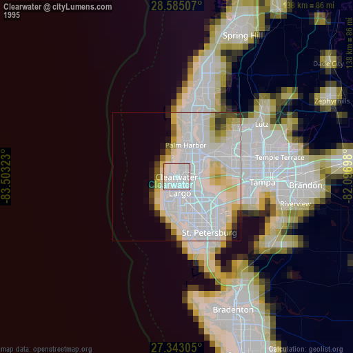
» NASA, Earths city lights 1995
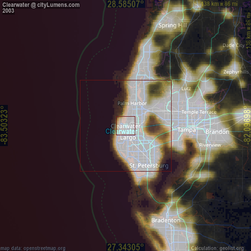
» NASA city lights 2003
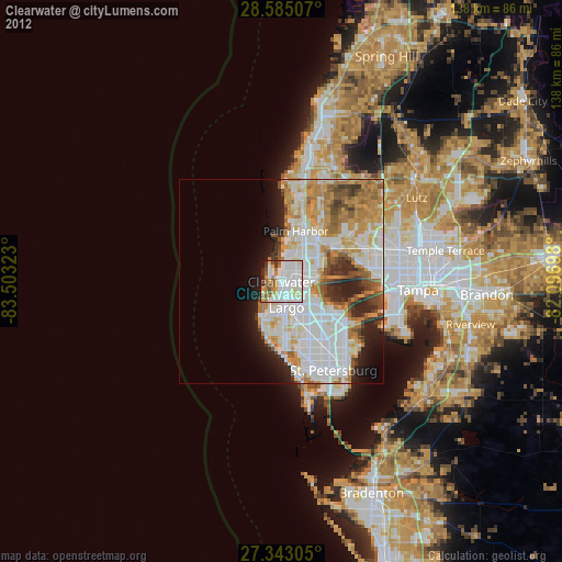
» Earth at Night: Flat Maps 2012, 2016
Src.2: Shane Kimbrough Twitter@astro_kimbroughĀĀ2017-01-12