Safety Harbor night lights from space
Night Light of Safety Harbor (Florida) from space (United States) Src. Average luminocity for 10x10km area is 70.7898% and for 50x50km: 56.6343%.
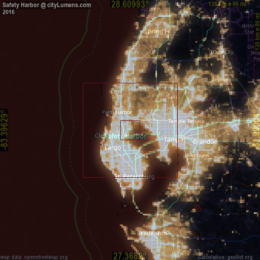
Analysis of Safety Harbor night lights 2016
Square area 10x10 km:
 21.97%
90-99
17.61%80-89
5.68%70-79
7.01%60-69
8.71%50-59
12.5%40-49
9.66%30-39
8.9%20-29
7.95%10-19
0%0-9
0%Square area 50x50 km:
19.66%90-99
12.99%80-89
5.76%70-79
6.54%60-69
10.06%50-59
4.56%40-49
3.95%30-39
3.26%20-29
6.42%10-19
6.1%0-9
20.69%Clear (daylight) street map image can be seen on geolist.org.
Map coordinates:
28° 36' 35.7" North, 83° 23' 46.6" West
27° 59' 27.1" North, 82° 41' 35.4" West
27° 22' 5.5" North, 81° 59' 24.1" West
Some cities around Safety Harbor sort by population:
• Clearwater
10.9 km =6.8 mi,  255°
255°
• Largo
13 km =8.1 mi,  226°
226°
• Town 'n' Country
11.6 km =7.2 mi,  79°
79°
• Palm Harbor
11.9 km =7.4 mi,  324°
324°
• Dunedin
8.5 km =5.3 mi,  292°
292°
• Westchase
10.9 km =6.8 mi,  48°
48°
• Oldsmar
5.5 km =3.4 mi,  29°
29°
• South Highpoint
8.4 km =5.2 mi,  193°
193°
4170797 (p: 17,454)
Sources (retrieved 2019-11-25):
» Earth at Night: Flat Maps 2012, 2016