Seminole night lights from space
Night Light of Seminole (Florida) from space (United States) Src. Average luminocity for 10x10km area is 84.2348% and for 50x50km: 35.1028%.
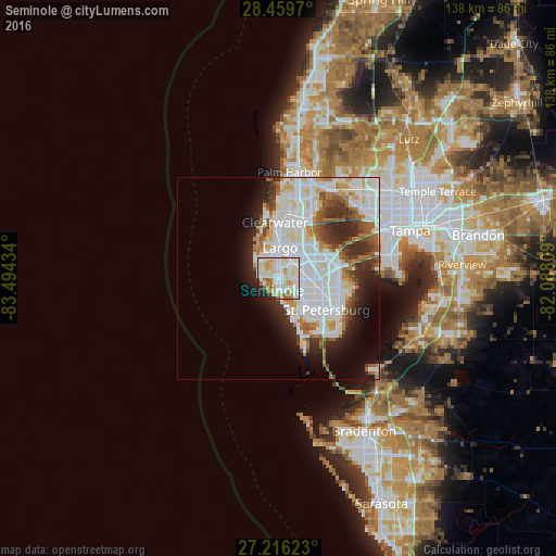
Analysis of Seminole night lights 2016
Square area 10x10 km:
 29.36%
90-99
26.89%80-89
17.61%70-79
7.01%60-69
7.01%50-59
2.84%40-49
1.14%30-39
0.95%20-29
5.87%10-19
1.33%0-9
0%Square area 50x50 km:
13.35%90-99
9%80-89
3.07%70-79
2.16%60-69
3.54%50-59
2.65%40-49
2.65%30-39
3.04%20-29
6.17%10-19
6.18%0-9
48.18%Clear (daylight) street map image can be seen on geolist.org.
Map coordinates:
28° 27' 34.9" North, 83° 29' 39.6" West
27° 50' 23.1" North, 82° 47' 28.4" West
27° 12' 58.4" North, 82° 5' 17.1" West
Some cities around Seminole sort by population:
• Largo
7.8 km =4.8 mi,  2°
2°
• Pinellas Park
9 km =5.6 mi,  87°
87°
• West and East Lealman
10.2 km =6.3 mi,  102°
102°
• Lealman
11.2 km =7 mi, 100°
• Treasure Island
8.1 km =5 mi,  164°
164°
• South Highpoint
11.5 km =7.1 mi,  41°
41°
• South Pasadena
10.8 km =6.7 mi,  150°
150°
• Kenneth City
7.5 km =4.7 mi,  111°
111°
4172434 (p: 18,153)
Sources (retrieved 2019-11-25):
» Earth at Night: Flat Maps 2012, 2016