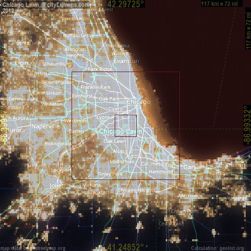
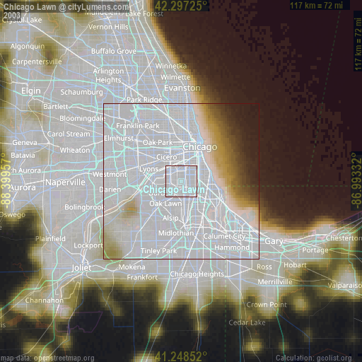
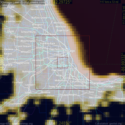
Chicago Lawn night lights from space
Night Light of Chicago Lawn (Illinois) from space (United States) Src. Average luminocity for 10x10km area is 100% and for 50x50km: 75.3231%.
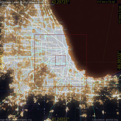
Analysis of Chicago Lawn night lights 2016
Square area 10x10 km:
 100%
100%90-99
0%80-89
0%70-79
0%60-69
0%50-59
0%40-49
0%30-39
0%20-29
0%10-19
0%0-9
0%Square area 50x50 km:
42.97%90-99
17.05%80-89
6.4%70-79
4.06%60-69
4.15%50-59
4.26%40-49
2.18%30-39
1.46%20-29
1.45%10-19
2.02%0-9
13.99%Clear (daylight) street map image can be seen on geolist.org.
Map coordinates:
42° 17' 50.1" North, 88° 23' 58.5" West
41° 46' 30.1" North, 87° 41' 47.2" West
41° 14' 54.7" North, 86° 59' 36" West
Some cities around Chicago Lawn sort by population:
• Brighton Park
4.9 km =3 mi,  357°
357°
• Ashburn
3.3 km =2.1 mi,  201°
201°
• Gage Park
2.2 km =1.4 mi,  0°
0°
• New City
4.9 km =3 mi,  42°
42°
• West Lawn
2.2 km =1.4 mi,  263°
263°
• West Englewood
2.5 km =1.6 mi,  82°
82°
• Englewood
4.2 km =2.6 mi, 82°
• West Elsdon
3.1 km =1.9 mi,  312°
312°
4887463 (p: 55,551)
Sources (retrieved 2019-11-25):
» NASA, Earths city lights 1995
» NASA city lights 2003
» Earth at Night: Flat Maps 2012, 2016