West Elsdon night lights from space
Night Light of West Elsdon (Illinois) from space (United States) Src. Average luminocity for 10x10km area is 100% and for 50x50km: 77.3638%.
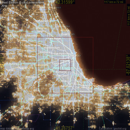
Analysis of West Elsdon night lights 2016
Square area 10x10 km:
 100%
100%90-99
0%80-89
0%70-79
0%60-69
0%50-59
0%40-49
0%30-39
0%20-29
0%10-19
0%0-9
0%Square area 50x50 km:
44.75%90-99
17.95%80-89
6.26%70-79
3.83%60-69
3.97%50-59
3.93%40-49
2.19%30-39
1.48%20-29
1.41%10-19
1.94%0-9
12.31%Clear (daylight) street map image can be seen on geolist.org.
Map coordinates:
42° 18' 57.6" North, 88° 25' 39.5" West
41° 47' 38.1" North, 87° 43' 28.2" West
41° 16' 3.3" North, 87° 1' 17" West
Some cities around West Elsdon sort by population:
• South Lawndale
5.6 km =3.5 mi,  10°
10°
• Chicago Lawn
3.1 km =1.9 mi,  132°
132°
• Brighton Park
3.5 km =2.2 mi,  37°
37°
• Ashburn
5.3 km =3.3 mi,  167°
167°
• Gage Park
2.4 km =1.5 mi,  86°
86°
• New City
5.8 km =3.6 mi,  74°
74°
• McKinley Park
5.9 km =3.7 mi,  45°
45°
• Stickney
5.7 km =3.5 mi,  302°
302°
4915987 (p: 19,219)
Sources (retrieved 2019-11-25):
» Earth at Night: Flat Maps 2012, 2016