Brighton Park night lights from space
Night Light of Brighton Park (Illinois) from space (United States) Src. Average luminocity for 10x10km area is 100% and for 50x50km: 71.9034%.
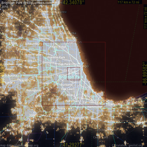
Analysis of Brighton Park night lights 2016
Square area 10x10 km:
 100%
100%90-99
0%80-89
0%70-79
0%60-69
0%50-59
0%40-49
0%30-39
0%20-29
0%10-19
0%0-9
0%Square area 50x50 km:
42.25%90-99
16.65%80-89
5.26%70-79
3.17%60-69
3.46%50-59
3.54%40-49
2.23%30-39
1.62%20-29
1.64%10-19
2.3%0-9
17.87%Clear (daylight) street map image can be seen on geolist.org.
Map coordinates:
42° 20' 26.8" North, 88° 24' 7.5" West
41° 49' 8.1" North, 87° 41' 56.2" West
41° 17' 34" North, 86° 59' 45" West
Some cities around Brighton Park sort by population:
• South Lawndale
3 km =1.9 mi,  337°
337°
• Gage Park
2.7 km =1.7 mi,  175°
175°
• New City
3.7 km =2.3 mi,  109°
109°
• North Lawndale
4.8 km =3 mi, 340°
• Lower West Side
4.8 km =3 mi,  35°
35°
• Bridgeport
4.5 km =2.8 mi,  61°
61°
• West Elsdon
3.5 km =2.2 mi,  217°
217°
• McKinley Park
2.5 km =1.6 mi, 55°
4885597 (p: 44,202)
Sources (retrieved 2019-11-25):
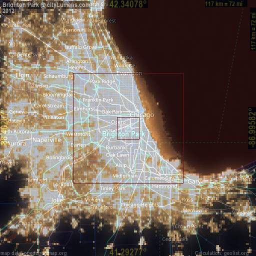
» Earth at Night: Flat Maps 2012, 2016