Chesterfield night lights from space
Night Light of Chesterfield (Missouri) from space (United States) Src. Average luminocity for 10x10km area is 66.5601% and for 50x50km: 54.4099%.
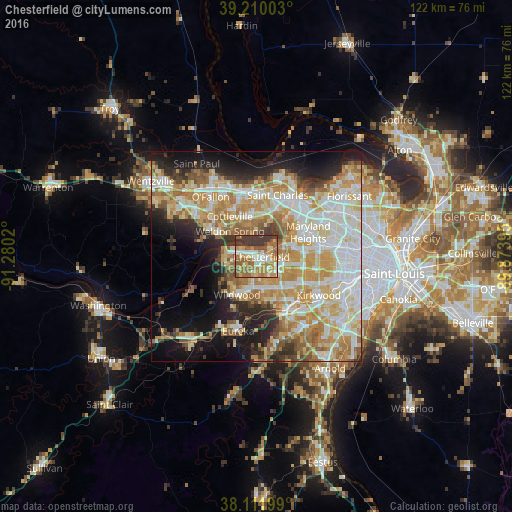
Analysis of Chesterfield night lights 2016
Square area 10x10 km:
 9.42%
9.42%90-99
9.25%80-89
9.74%70-79
16.4%60-69
19.32%50-59
12.66%40-49
2.92%30-39
20.29%20-29
0%10-19
0%0-9
0%Square area 50x50 km:
11.87%90-99
11.84%80-89
8.69%70-79
10.88%60-69
8.73%50-59
5.41%40-49
3.42%30-39
4.75%20-29
7.01%10-19
11.24%0-9
16.16%Clear (daylight) street map image can be seen on geolist.org.
Map coordinates:
39° 12' 36.1" North, 91° 16' 48.7" West
38° 39' 47.2" North, 90° 34' 37.5" West
38° 6' 43.2" North, 89° 52' 26.2" West
Some cities around Chesterfield sort by population:
• Wildwood
11.6 km =7.2 mi,  219°
219°
• Ballwin
8 km =5 mi,  160°
160°
• Maryland Heights
13.9 km =8.6 mi,  66°
66°
• Creve Coeur
13.4 km =8.3 mi,  91°
91°
• Manchester
9.4 km =5.8 mi,  141°
141°
• Town and Country
11.4 km =7.1 mi,  119°
119°
• Ellisville
7.9 km =4.9 mi,  186°
186°
• Weldon Spring
11.2 km =7 mi,  299°
299°
4381072 (p: 47,864)
Sources (retrieved 2019-11-25):
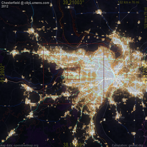
» Earth at Night: Flat Maps 2012, 2016