Town and Country night lights from space
Night Light of Town and Country (Missouri) from space (United States) Src. Average luminocity for 10x10km area is 83.5584% and for 50x50km: 64.5305%.
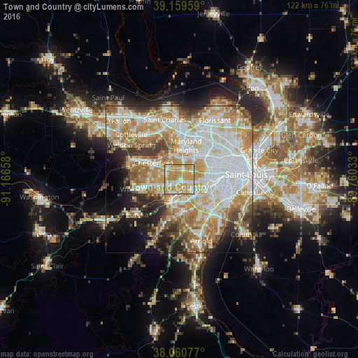
Analysis of Town and Country night lights 2016
Square area 10x10 km:
 17.53%
90-99
19.16%80-89
9.25%70-79
47.89%60-69
6.17%50-59
0%40-49
0%30-39
0%20-29
0%10-19
0%0-9
0%Square area 50x50 km:
17.26%90-99
14.43%80-89
9.46%70-79
12.15%60-69
9.72%50-59
6.51%40-49
4.22%30-39
4.86%20-29
5.92%10-19
7.48%0-9
7.99%Clear (daylight) street map image can be seen on geolist.org.
Map coordinates:
39° 9' 34.5" North, 91° 9' 59.7" West
38° 36' 44.2" North, 90° 27' 48.4" West
38° 3' 38.8" North, 89° 45' 37.2" West
Some cities around Town and Country sort by population:
• Ballwin
7.4 km =4.6 mi,  255°
255°
• Kirkwood
5.9 km =3.7 mi,  123°
123°
• Creve Coeur
6.5 km =4 mi,  33°
33°
• Manchester
4.3 km =2.7 mi,  246°
246°
• Ladue
8.3 km =5.2 mi,  59°
59°
• Des Peres
2.9 km =1.8 mi, 115°
• Valley Park
7.5 km =4.7 mi,  199°
199°
• Glendale
7.7 km =4.8 mi,  103°
103°
4411912 (p: 11,106)
Sources (retrieved 2019-11-25):
» Earth at Night: Flat Maps 2012, 2016