Germantown night lights from space
Night Light of Germantown (Wisconsin) from space (United States) Src. Average luminocity for 10x10km area is 46.6045% and for 50x50km: 37.1252%.
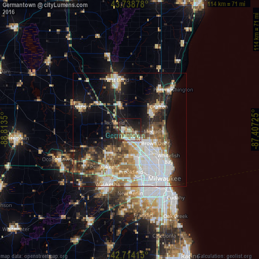

Analysis of Germantown night lights 2016
Square area 10x10 km:
 7.27%
7.27%90-99
7.27%80-89
7.27%70-79
5.91%60-69
5.15%50-59
8.48%40-49
8.33%30-39
8.18%20-29
16.36%10-19
19.39%0-9
6.36%Square area 50x50 km:
10.69%90-99
6.43%80-89
3.94%70-79
3.38%60-69
5%50-59
5.01%40-49
4.77%30-39
4.01%20-29
7.52%10-19
14.96%0-9
34.3%Clear (daylight) street map image can be seen on geolist.org.
Map coordinates:
43° 44' 19.6" North, 88° 48' 48.6" West
43° 13' 43" North, 88° 6' 37.3" West
42° 42' 50.9" North, 87° 24' 26.1" West
Some cities around Germantown sort by population:
• Menomonee Falls
5.6 km =3.5 mi,  185°
185°
• Mequon
6.7 km =4.2 mi,  102°
102°
• Brown Deer
13.9 km =8.6 mi,  121°
121°
• Richfield
7.4 km =4.6 mi,  294°
294°
• Grafton
16.3 km =10.1 mi,  51°
51°
• Cedarburg
12.5 km =7.8 mi, 52°
• Sussex
13.9 km =8.6 mi,  220°
220°
• Jackson
11.5 km =7.1 mi,  336°
336°
5254218 (p: 19,993)
Sources (retrieved 2019-11-25):
» Earth at Night: Flat Maps 2012, 2016