Fox Point night lights from space
Night Light of Fox Point (Wisconsin) from space (United States) Src. Average luminocity for 10x10km area is 47.5242% and for 50x50km: 33.4403%.
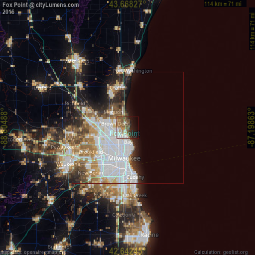
Analysis of Fox Point night lights 2016
Square area 10x10 km:
 10.3%
10.3%90-99
8.94%80-89
4.24%70-79
4.39%60-69
7.27%50-59
13.94%40-49
7.12%30-39
5%20-29
6.97%10-19
14.85%0-9
16.97%Square area 50x50 km:
12.6%90-99
6.3%80-89
2.7%70-79
3.08%60-69
4.22%50-59
3.79%40-49
3.57%30-39
2.86%20-29
5.41%10-19
7.81%0-9
47.66%Clear (daylight) street map image can be seen on geolist.org.
Map coordinates:
43° 40' 5.8" North, 88° 36' 17.6" West
43° 9' 27" North, 87° 54' 6.3" West
42° 38' 32.8" North, 87° 11' 55.1" West
Some cities around Fox Point sort by population:
• Milwaukee
13.2 km =8.2 mi,  181°
181°
• Wauwatosa
14.8 km =9.2 mi,  215°
215°
• Mequon
12.2 km =7.6 mi,  301°
301°
• Whitefish Bay
4.9 km =3 mi, 178°
• Shorewood
7.7 km =4.8 mi,  171°
171°
• Glendale
3.7 km =2.3 mi,  228°
228°
• Brown Deer
5.1 km =3.2 mi,  277°
277°
• Cedarburg
17 km =10.6 mi,  335°
335°
5253662 (p: 6,755)
Sources (retrieved 2019-11-25):
» Earth at Night: Flat Maps 2012, 2016