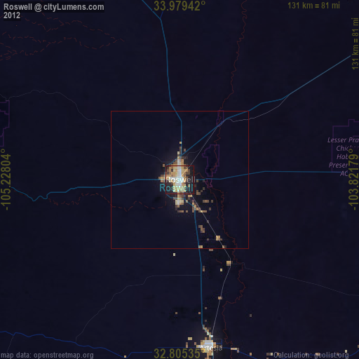
Roswell night lights from space
Night Light of Roswell (New Mexico) from space (United States) Src. Average luminocity for 10x10km area is 59.9563% and for 50x50km: 5.4765%.
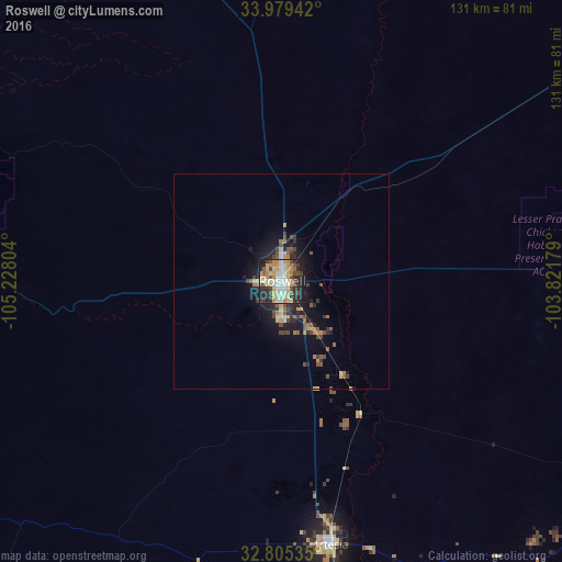
Analysis of Roswell night lights 2016
Square area 10x10 km:
 9.09%
9.09%90-99
12.06%80-89
13.81%70-79
12.76%60-69
5.59%50-59
4.72%40-49
7.52%30-39
6.29%20-29
19.58%10-19
8.57%0-9
0%Square area 50x50 km:
0.43%90-99
0.6%80-89
0.9%70-79
0.85%60-69
0.68%50-59
0.77%40-49
1.06%30-39
0.83%20-29
1.76%10-19
3.81%0-9
88.3%Clear (daylight) street map image can be seen on geolist.org.
Map coordinates:
33° 58' 45.9" North, 105° 13' 40.9" West
33° 23' 39.7" North, 104° 31' 29.7" West
32° 48' 19.3" North, 103° 49' 18.4" West
Some cities around Roswell sort by population:
• Clovis
165.7 km =103 mi,  47°
47°
• Hobbs
150.6 km =93.6 mi,  120°
120°
• Alamogordo
144.5 km =89.8 mi,  247°
247°
• Carlsbad
111.7 km =69.4 mi,  165°
165°
• Artesia
62.4 km =38.8 mi, 169°
• Portales
140.9 km =87.6 mi, 51°
• Lovington
120.4 km =74.8 mi,  114°
114°
• Ruidoso
106.8 km =66.4 mi,  266°
266°
5488441 (p: 48,544)
Sources (retrieved 2019-11-25):
» Earth at Night: Flat Maps 2012, 2016