Artesia night lights from space
Night Light of Artesia (New Mexico) from space (United States) Src. Average luminocity for 10x10km area is 42.1503% and for 50x50km: 3.0833%.
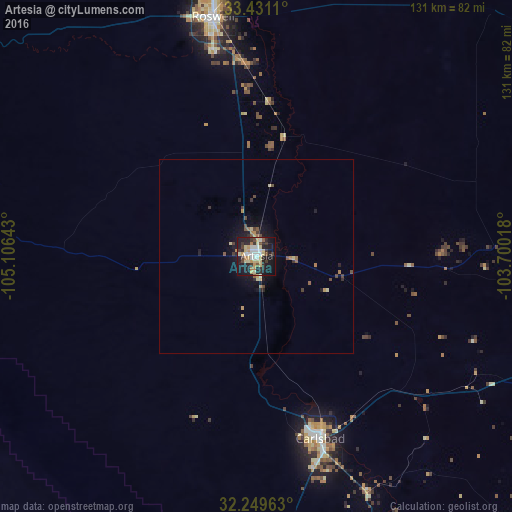
Analysis of Artesia night lights 2016
Square area 10x10 km:
 5.94%
5.94%90-99
5.94%80-89
11.71%70-79
5.42%60-69
3.5%50-59
2.62%40-49
3.67%30-39
7.17%20-29
15.38%10-19
33.04%0-9
5.59%Square area 50x50 km:
0.25%90-99
0.25%80-89
0.68%70-79
0.41%60-69
0.39%50-59
0.27%40-49
0.48%30-39
0.54%20-29
0.87%10-19
2.5%0-9
93.37%Clear (daylight) street map image can be seen on geolist.org.
Map coordinates:
33° 25' 52" North, 105° 6' 23.1" West
32° 50' 32.4" North, 104° 24' 11.9" West
32° 14' 58.7" North, 103° 42' 0.6" West
Some cities around Artesia sort by population:
• Roswell
62.4 km =38.8 mi,  349°
349°
• Hobbs
119.5 km =74.3 mi,  97°
97°
• Alamogordo
145.5 km =90.4 mi,  272°
272°
• Carlsbad
49.6 km =30.8 mi,  160°
160°
• Lovington
99.1 km =61.6 mi,  83°
83°
• Ruidoso
130.2 km =80.9 mi,  294°
294°
• Seminole
164.9 km =102.5 mi,  94°
94°
• Kermit
164.8 km =102.4 mi,  131°
131°
5455796 (p: 12,036)
Sources (retrieved 2019-11-25):
» Earth at Night: Flat Maps 2012, 2016