Buellton night lights from space
Night Light of Buellton (California) from space (United States) Src. Average luminocity for 10x10km area is 7% and for 50x50km: 1.552%.
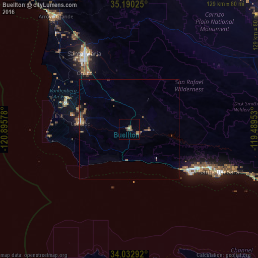
Analysis of Buellton night lights 2016
Square area 10x10 km:
 0%
0%90-99
0%80-89
0.7%70-79
1.4%60-69
3.15%50-59
1.05%40-49
2.1%30-39
1.4%20-29
0%10-19
1.4%0-9
88.81%Square area 50x50 km:
0.07%90-99
0.07%80-89
0.11%70-79
0.16%60-69
0.37%50-59
0.43%40-49
0.62%30-39
0.18%20-29
0.06%10-19
0.75%0-9
97.17%Clear (daylight) street map image can be seen on geolist.org.
Map coordinates:
35° 11' 24.9" North, 120° 53' 44.8" West
34° 36' 49" North, 120° 11' 33.5" West
34° 1' 58.5" North, 119° 29' 22.3" West
Some cities around Buellton sort by population:
• Santa Maria
43.8 km =27.2 mi,  329°
329°
• Santa Barbara
50.1 km =31.1 mi,  115°
115°
• Lompoc
24.4 km =15.2 mi,  276°
276°
• Goleta
38.8 km =24.1 mi, 120°
• Orcutt
35.7 km =22.2 mi,  321°
321°
• Isla Vista
37.7 km =23.4 mi,  126°
126°
• Vandenberg Village
27.3 km =17 mi,  292°
292°
• Solvang
5.4 km =3.4 mi,  111°
111°
5331568 (p: 5,082)
Sources (retrieved 2019-11-25):
» Earth at Night: Flat Maps 2012, 2016