Santa Barbara night lights from space
Night Light of Santa Barbara (California) from space (United States) Src. Average luminocity for 10x10km area is 40.4266% and for 50x50km: 5.5933%.
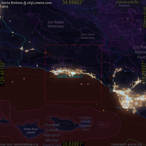
Analysis of Santa Barbara night lights 2016
Square area 10x10 km:
 3.85%
3.85%90-99
5.42%80-89
3.15%70-79
3.15%60-69
9.44%50-59
10.14%40-49
13.64%30-39
4.55%20-29
5.94%10-19
36.71%0-9
4.02%Square area 50x50 km:
0.49%90-99
0.55%80-89
0.34%70-79
0.57%60-69
1.05%50-59
1.21%40-49
1.65%30-39
0.59%20-29
0.86%10-19
5.46%0-9
87.23%Clear (daylight) street map image can be seen on geolist.org.
Map coordinates:
34° 59' 55.8" North, 120° 24' 4.8" West
34° 25' 15" North, 119° 41' 53.5" West
33° 50' 19.7" North, 118° 59' 42.3" West
Some cities around Santa Barbara sort by population:
• Ventura
40.4 km =25.1 mi,  113°
113°
• Goleta
12 km =7.5 mi,  277°
277°
• Isla Vista
15 km =9.3 mi,  266°
266°
• Carpinteria
16.7 km =10.4 mi,  98°
98°
• Montecito
6.3 km =3.9 mi,  73°
73°
• Ojai
41.9 km =26 mi,  85°
85°
• Mira Monte
37.9 km =23.5 mi, 87°
• Solvang
44.7 km =27.8 mi,  295°
295°
5392952 (p: 91,842)
Sources (retrieved 2019-11-25):
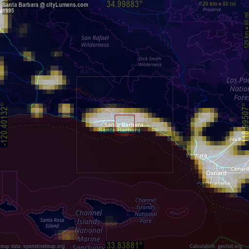
» NASA, Earths city lights 1995
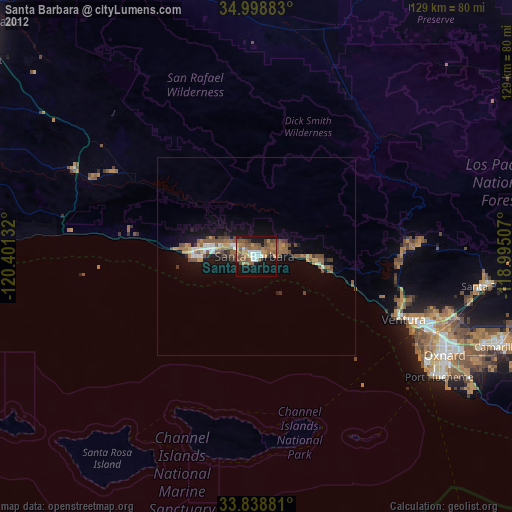
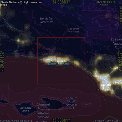
» NASA city lights 2003
» Earth at Night: Flat Maps 2012, 2016