Santa Maria night lights from space
Night Light of Santa Maria (California) from space (United States) Src. Average luminocity for 10x10km area is 50.9414% and for 50x50km: 6.4914%.
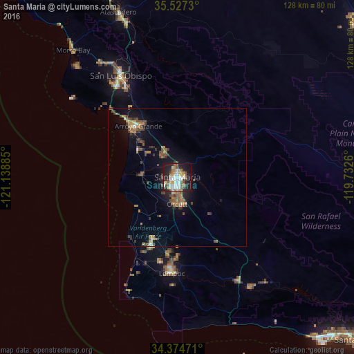
Analysis of Santa Maria night lights 2016
Square area 10x10 km:
 9.34%
9.34%90-99
14.47%80-89
2.93%70-79
7.88%60-69
7.51%50-59
6.04%40-49
5.13%30-39
3.48%20-29
15.75%10-19
25.09%0-9
2.38%Square area 50x50 km:
0.49%90-99
0.76%80-89
0.33%70-79
0.93%60-69
1.36%50-59
1.05%40-49
1.45%30-39
1.07%20-29
1.35%10-19
5.02%0-9
86.18%Clear (daylight) street map image can be seen on geolist.org.
Map coordinates:
35° 31' 38.3" North, 121° 8' 19.9" West
34° 57' 10.9" North, 120° 26' 8.6" West
34° 22' 29" North, 119° 43' 57.4" West
Some cities around Santa Maria sort by population:
• Orcutt
9.8 km =6.1 mi,  180°
180°
• Arroyo Grande
23.2 km =14.4 mi,  322°
322°
• Nipomo
10.6 km =6.6 mi,  339°
339°
• Grover Beach
25.2 km =15.7 mi, 317°
• Pismo Beach
28.2 km =17.5 mi, 318°
• Guadalupe
12.6 km =7.8 mi,  279°
279°
• Oceano
22.8 km =14.2 mi, 315°
• Vandenberg Village
27.4 km =17 mi,  186°
186°
5393180 (p: 105,093)
Sources (retrieved 2019-11-25):
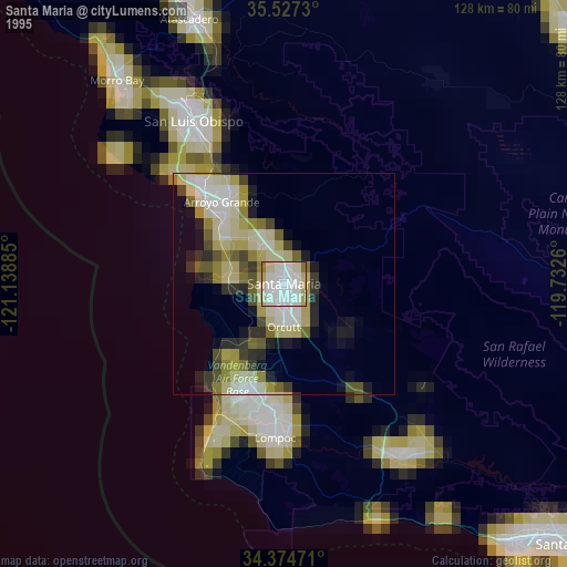
» NASA, Earths city lights 1995
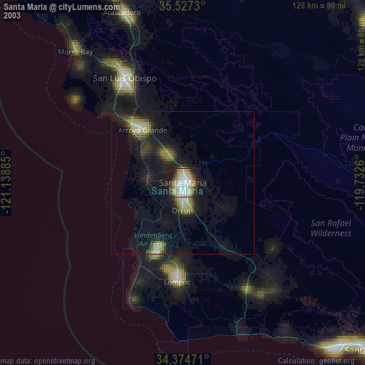
» NASA city lights 2003
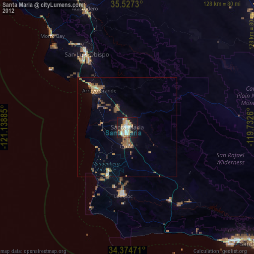
» Earth at Night: Flat Maps 2012, 2016