Lompoc night lights from space
Night Light of Lompoc (California) from space (United States) Src. Average luminocity for 10x10km area is 23.5699% and for 50x50km: 3.1231%.

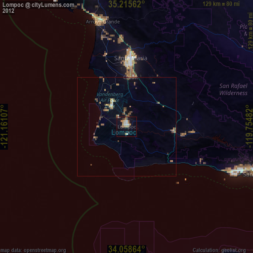
Analysis of Lompoc night lights 2016
Square area 10x10 km:
 2.1%
2.1%90-99
2.1%80-89
2.1%70-79
3.5%60-69
3.15%50-59
8.22%40-49
4.72%30-39
1.92%20-29
1.92%10-19
22.73%0-9
47.55%Square area 50x50 km:
0.13%90-99
0.17%80-89
0.2%70-79
0.43%60-69
0.72%50-59
0.6%40-49
0.88%30-39
0.62%20-29
0.29%10-19
2.51%0-9
93.46%Clear (daylight) street map image can be seen on geolist.org.
Map coordinates:
35° 12' 56.2" North, 121° 9' 39.9" West
34° 38' 20.9" North, 120° 27' 28.6" West
34° 3' 31.1" North, 119° 45' 17.4" West
Some cities around Lompoc sort by population:
• Santa Maria
35 km =21.7 mi,  3°
3°
• Orcutt
25.2 km =15.7 mi, 4°
• Nipomo
44.9 km =27.9 mi,  357°
357°
• Guadalupe
38.4 km =23.9 mi,  344°
344°
• Oceano
53 km =32.9 mi, 344°
• Vandenberg Village
7.7 km =4.8 mi,  353°
353°
• Solvang
29.7 km =18.5 mi,  99°
99°
• Buellton
24.4 km =15.2 mi, 96°
5367788 (p: 44,164)
Sources (retrieved 2019-11-25):
» Earth at Night: Flat Maps 2012, 2016