Brush night lights from space
Night Light of Brush (Colorado) from space (United States) Src. Average luminocity for 10x10km area is 9.9951% and for 50x50km: 1.4937%.
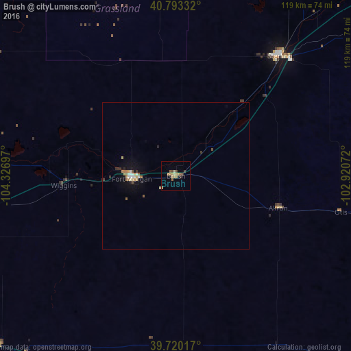
Analysis of Brush night lights 2016
Square area 10x10 km:
 0%
0%90-99
0.65%80-89
2.6%70-79
1.95%60-69
2.44%50-59
1.46%40-49
1.3%30-39
1.95%20-29
0%10-19
0.16%0-9
87.5%Square area 50x50 km:
0.12%90-99
0.16%80-89
0.26%70-79
0.23%60-69
0.27%50-59
0.15%40-49
0.11%30-39
0.25%20-29
0.09%10-19
0.84%0-9
97.52%Clear (daylight) street map image can be seen on geolist.org.
Map coordinates:
40° 47' 36" North, 104° 19' 37.1" West
40° 15' 31.9" North, 103° 37' 25.8" West
39° 43' 12.6" North, 102° 55' 14.6" West
Some cities around Brush sort by population:
• Greeley
93.8 km =58.3 mi,  281°
281°
• Brighton
106.2 km =66 mi,  253°
253°
• Evans
91.5 km =56.9 mi, 278°
• Sterling
53.9 km =33.5 mi,  40°
40°
• Fort Morgan
15 km =9.3 mi,  266°
266°
• Fort Lupton
102.9 km =63.9 mi,  259°
259°
• Milliken
104.7 km =65.1 mi, 274°
• Lochbuie
97 km =60.3 mi, 253°
5575194 (p: 5,459)
Sources (retrieved 2019-11-25):
» Earth at Night: Flat Maps 2012, 2016