Boca Raton night lights from space
Night Light of Boca Raton (Florida) from space (United States) Src. Average luminocity for 10x10km area is 75.2898% and for 50x50km: 41.7674%.
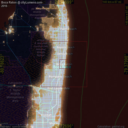
Analysis of Boca Raton night lights 2016
Square area 10x10 km:
 32.77%
90-99
29.17%80-89
1.7%70-79
1.14%60-69
3.41%50-59
1.89%40-49
6.44%30-39
5.3%20-29
12.12%10-19
6.06%0-9
0%Square area 50x50 km:
19.33%90-99
12.48%80-89
2.76%70-79
1.56%60-69
2.52%50-59
2.3%40-49
2.24%30-39
2.52%20-29
3.89%10-19
5.5%0-9
44.9%Clear (daylight) street map image can be seen on geolist.org.
Map coordinates:
26° 59' 13.2" North, 80° 47' 10.4" West
26° 21' 31.3" North, 80° 4' 59.2" West
25° 43' 37.1" North, 79° 22' 47.9" West
Some cities around Boca Raton sort by population:
• Pompano Beach
14.1 km =8.8 mi,  197°
197°
• Deerfield Beach
4.8 km =3 mi, 200°
• Delray Beach
11.5 km =7.1 mi,  5°
5°
• Coconut Creek
15.3 km =9.5 mi,  218°
218°
• Sandalfoot Cove
10.6 km =6.6 mi,  257°
257°
• Kings Point
11.2 km =7 mi,  329°
329°
• Lighthouse Point
9.2 km =5.7 mi,  182°
182°
• Pompano Beach Highlands
8.8 km =5.5 mi, 195°
4148411 (p: 93,235)
Sources (retrieved 2019-11-25):
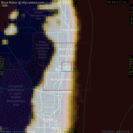
» NASA, Earths city lights 1995
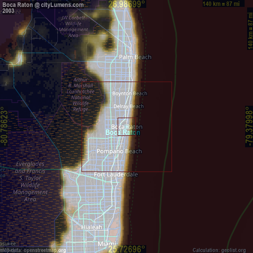
» NASA city lights 2003
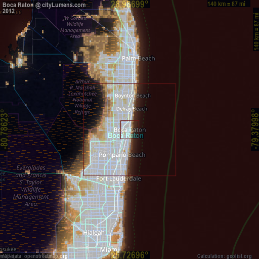
» Earth at Night: Flat Maps 2012, 2016