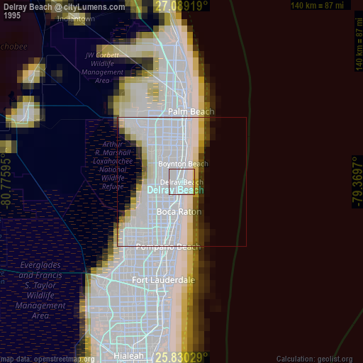
Delray Beach night lights from space
Night Light of Delray Beach (Florida) from space (United States) Src. Average luminocity for 10x10km area is 72.3864% and for 50x50km: 41.3204%.

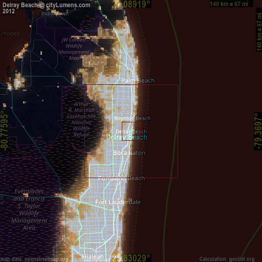

Analysis of Delray Beach night lights 2016
Square area 10x10 km:
 30.11%
90-99
23.48%80-89
8.71%70-79
0.76%60-69
1.52%50-59
4.17%40-49
4.73%30-39
5.68%20-29
12.88%10-19
7.95%0-9
0%Square area 50x50 km:
15.08%90-99
13.8%80-89
4.07%70-79
2.42%60-69
3.87%50-59
2.32%40-49
2.01%30-39
2.05%20-29
4.4%10-19
5.79%0-9
44.18%Clear (daylight) street map image can be seen on geolist.org.
Map coordinates:
27° 5' 21.1" North, 80° 46' 33.4" West
26° 27' 41.3" North, 80° 4' 22.2" West
25° 49' 49" North, 79° 22' 10.9" West
Some cities around Delray Beach sort by population:
• Boca Raton
11.5 km =7.1 mi,  185°
185°
• Deerfield Beach
16.1 km =10 mi, 189°
• Boynton Beach
7.1 km =4.4 mi,  5°
5°
• Lake Worth
17.3 km =10.7 mi,  0°
0°
• Boca Del Mar
14.9 km =9.3 mi,  209°
209°
• Lake Worth Corridor
17.5 km =10.9 mi,  350°
350°
• Kings Point
6.9 km =4.3 mi,  254°
254°
• Lantana
14.1 km =8.8 mi, 8°
4153132 (p: 66,255)
Sources (retrieved 2019-11-25):
» NASA, Earths city lights 1995
» NASA city lights 2003
» Earth at Night: Flat Maps 2012, 2016