Pompano Beach night lights from space
Night Light of Pompano Beach (Florida) from space (United States) Src. Average luminocity for 10x10km area is 93.9762% and for 50x50km: 48.0118%.
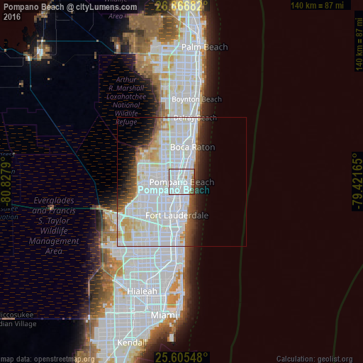
Analysis of Pompano Beach night lights 2016
Square area 10x10 km:
 68.85%
90-99
17.86%80-89
0.6%70-79
1.39%60-69
2.38%50-59
5.75%40-49
2.98%30-39
0.2%20-29
0%10-19
0%0-9
0%Square area 50x50 km:
23.75%90-99
13.6%80-89
3.17%70-79
2.29%60-69
2.27%50-59
2.32%40-49
2.63%30-39
2.55%20-29
3.36%10-19
5.14%0-9
38.94%Clear (daylight) street map image can be seen on geolist.org.
Map coordinates:
26° 52' 0.6" North, 80° 49' 40.4" West
26° 14' 16.3" North, 80° 7' 29.2" West
25° 36' 19.7" North, 79° 25' 17.9" West
Some cities around Pompano Beach sort by population:
• Deerfield Beach
9.3 km =5.8 mi,  15°
15°
• Coconut Creek
5.6 km =3.5 mi,  285°
285°
• Margate
8.2 km =5.1 mi,  275°
275°
• Oakland Park
7.3 km =4.5 mi,  185°
185°
• Wilton Manors
8.7 km =5.4 mi, 189°
• Lighthouse Point
5.6 km =3.5 mi,  41°
41°
• North Andrews Gardens
5.5 km =3.4 mi,  200°
200°
• Lauderdale-by-the-Sea
5.8 km =3.6 mi,  150°
150°
4169014 (p: 107,762)
Sources (retrieved 2019-11-25):
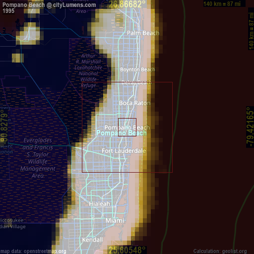
» NASA, Earths city lights 1995
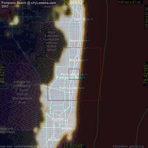
» NASA city lights 2003
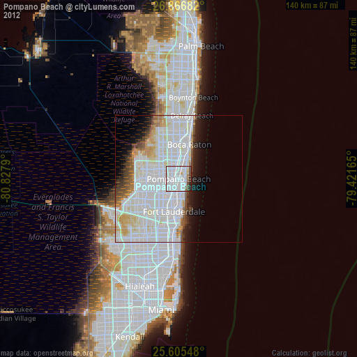
» Earth at Night: Flat Maps 2012, 2016