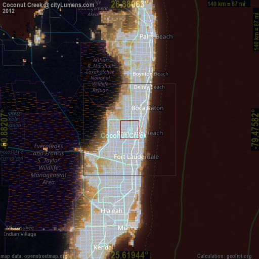
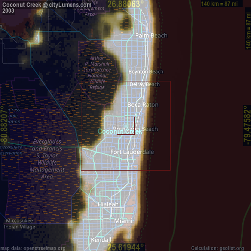
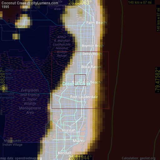
Coconut Creek night lights from space
Night Light of Coconut Creek (Florida) from space (United States) Src. Average luminocity for 10x10km area is 99.123% and for 50x50km: 49.778%.
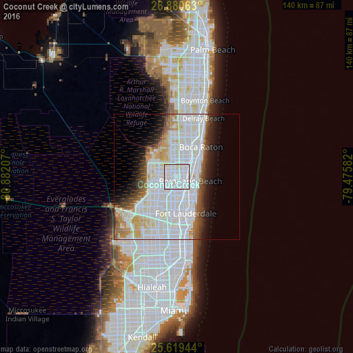
Analysis of Coconut Creek night lights 2016
Square area 10x10 km:
 73.41%
90-99
23.81%80-89
2.78%70-79
0%60-69
0%50-59
0%40-49
0%30-39
0%20-29
0%10-19
0%0-9
0%Square area 50x50 km:
23.35%90-99
13.78%80-89
3.58%70-79
2.74%60-69
3.34%50-59
2.68%40-49
2.91%30-39
2.85%20-29
3.7%10-19
5.65%0-9
35.43%Clear (daylight) street map image can be seen on geolist.org.
Map coordinates:
26° 52' 50.3" North, 80° 52' 55.5" West
26° 15' 6.3" North, 80° 10' 44.2" West
25° 37' 10" North, 79° 28' 33" West
Some cities around Coconut Creek sort by population:
• Coral Springs
9.4 km =5.8 mi,  283°
283°
• Pompano Beach
5.6 km =3.5 mi,  105°
105°
• Tamarac
8.3 km =5.2 mi,  238°
238°
• Margate
2.9 km =1.8 mi,  253°
253°
• North Lauderdale
6 km =3.7 mi,  230°
230°
• Parkland
8.7 km =5.4 mi,  318°
318°
• North Andrews Gardens
7.5 km =4.7 mi,  152°
152°
• Pompano Beach Highlands
8 km =5 mi,  64°
64°
4151455 (p: 59,302)
Sources (retrieved 2019-11-25):
» NASA, Earths city lights 1995
» NASA city lights 2003
» Earth at Night: Flat Maps 2012, 2016