Deerfield Beach night lights from space
Night Light of Deerfield Beach (Florida) from space (United States) Src. Average luminocity for 10x10km area is 85.1984% and for 50x50km: 43.6033%.
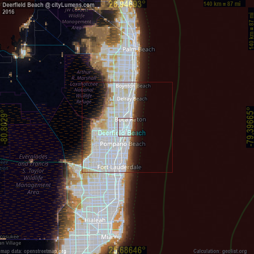
Analysis of Deerfield Beach night lights 2016
Square area 10x10 km:
 45.04%
90-99
29.17%80-89
1.79%70-79
0%60-69
2.78%50-59
3.97%40-49
7.34%30-39
3.97%20-29
5.95%10-19
0%0-9
0%Square area 50x50 km:
20.8%90-99
12.87%80-89
2.7%70-79
1.69%60-69
2.38%50-59
2.25%40-49
2.4%30-39
2.58%20-29
3.78%10-19
5.45%0-9
43.09%Clear (daylight) street map image can be seen on geolist.org.
Map coordinates:
26° 56' 48.9" North, 80° 48' 10.4" West
26° 19' 6.3" North, 80° 5' 59.2" West
25° 41' 11.3" North, 79° 23' 47.9" West
Some cities around Deerfield Beach sort by population:
• Pompano Beach
9.3 km =5.8 mi,  195°
195°
• Boca Raton
4.8 km =3 mi,  20°
20°
• Coconut Creek
10.8 km =6.7 mi,  226°
226°
• Margate
13.4 km =8.3 mi, 232°
• Boca Del Mar
5.5 km =3.4 mi,  302°
302°
• Sandalfoot Cove
9 km =5.6 mi,  284°
284°
• Lighthouse Point
4.9 km =3 mi,  165°
165°
• Pompano Beach Highlands
4 km =2.5 mi,  190°
190°
4153071 (p: 79,768)
Sources (retrieved 2019-11-25):
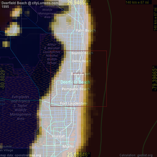
» NASA, Earths city lights 1995
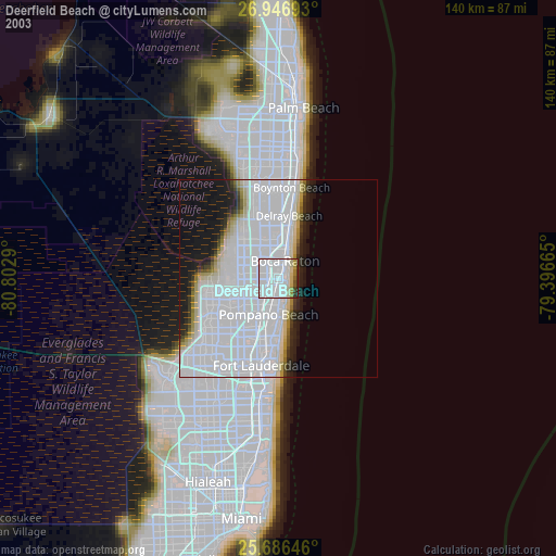
» NASA city lights 2003
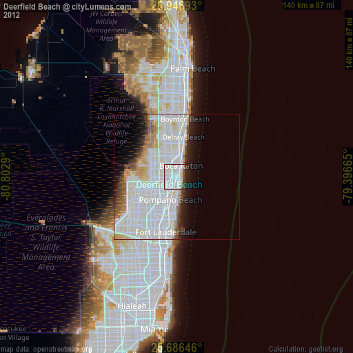
» Earth at Night: Flat Maps 2012, 2016